I lay in my sleeping bag nervously watching the tent flexing and straining under the force of the icy wind blowing down from the head of Eskdale, hoping it would hold as it was now too dark to shift camp to somewhere more sheltered. Memories of a past windy camp came back to both haunt me and at the same time boost my confidence that my tent would hold… Next morning I emerged to the new snowfall, pulling on my outer layers in the biting cold and tunneling my way out through the snowdrift surrounding Monica to inspect her sorry and bedraggled state after a night standing up to the Lake District winter…
Day 0: Friday 15 March
After writing my blog post about the preparations for this trip, in particular about the gear I was planning to use and how I was going to carry the load, fate had different ideas in store for me. After three attempts at packing the ULA Epic, I gave up and reverted to my trusty steed the Lowe Alpine Khumbu. Over 1kg heavier than the Epic, so more of a shire horse than a pony, but with that extra little bit of capacity needed to stow everything comfortably and without looking like Charles Hawtry in Carry on Camping. With the crushing 6kg weight of food for 6 days on board, the Khumbu just felt that little bit more safe a carry, albeit still staggeringly heavy. I also had to leave out the bivvy bag I’d intended to take as my strategy to add warmth and space to my shelter system. I went to bed starting to feel nervous about my ability to carry what was now a 20kg+ load.
Day 1: Saturday 16 March
I woke still feeling apprehensive about my load, but tried to forget about it as I staggered to the station to begin the journey. My pack weighed a ton, due mainly to the combination of a week’s food and the additional gear demands of winter backpacking. Memories of my first ill-fated backpack in the Lakes swirled around my mind for the rest of the day, until I just got on with it. That first attempt had been torpedoed by a combination of excessive pack weight and an over-ambitious walk plan. What’s more this latest trip was starting in exactly the same place as that trip way back in 2007, and I wondered if history was going to repeat itself.
Several trains later, on some of which I’d had to stand, and I pulled into Windermere several minutes late, much of which was down to the extra long stop at Staveley to disgorge most of the train’s passengers for the beer festival. The numbers “505” shone from the back of a bus already at the stop, and I ran (to the extent my load allowed) for the bus, not wanting to wait two hours for the next one and thereby smash my first day plan altogether. Infuriatingly, after making it, it then took a further 15 minutes to actually leave, meaning I could have topped up with desperately needed cash in the meantime.
I faffed around in Coniston, adjusting pacerpoles, setting the SPOT up for route tracking and reorganising my pack for walk mode, then set off on the walk up Coppermines. I slogged up the path, being overtaken by everyone. Slow and steady paid off and got me to Levers Water.
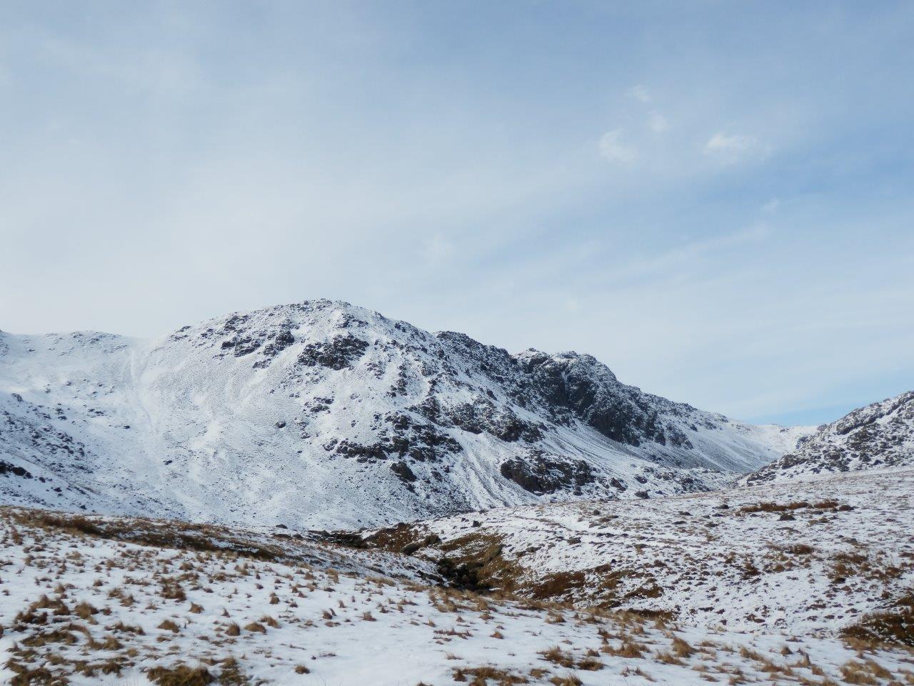
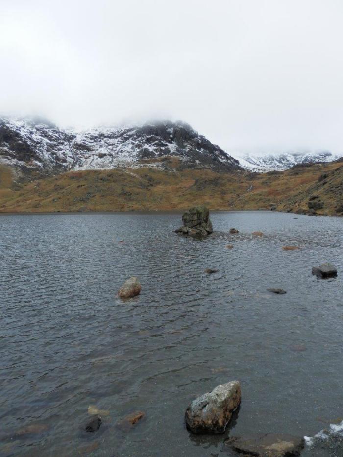 Levers Water

With fells looking like freshly-baked cakes dusted with icing sugar and the surface of the tarn a shimmering glacial blue, I carried on up through the snowline trying to follow what little path remained visible. I looked back down towards Coniston and the more autumnal colours displayed below. Motivation returned as I got higher and adjusted to the weight of my pack, and as the views became more extensive thoughts of bailing out of today’s walk early evaporated. With microspikes on my feet I arrived at Swirl Hawse and looked across towards Langdale, Pike o’Blisco pointing majestically skywards and my talisman of Pike of Stickle poking into the view behind.

Time-wise I was still looking hard-pushed to make my original intended camp spot on Cold Pike, so my thoughts turned to alternatives as I turned left to begin the ascent of the Prison Band. To my right unbroken patches of snow and thin air beyond revealed the dangers of straying too far from the path. I stuck to the route where rocks and wisps of grass still showed themselves and slowly made my way upwards. Even so, there was the occasional plunge into deeper snow. The sun showed itself over the top of the arete, signalling the coming sunset, and soon I reached the top and made my way over to the cairn, where I found a guy sitting looking into the cloudy vastness. We headed down together for a short way, and then I let him outstrip me as I started weighing up where to pitch.
I found a patch on Little Carrs that looked reasonably flat and which had views west and east giving sunset and sunrise potential. As I started inspecting the ground in more detail, a couple coming down from the summit reached me and stopped to talk. Their opening gambit said it all: “We’re on Swirl How, aren’t we ?”. I turned and pointed back up the ridge and put them right. Not quite believing me, the guy showed me his “map” – a small 4″ x 4″ square on the back of a walk leaflet, and I explained that this was the ridge down to Little Langdale, not the way down to Coniston that they wanted. Clad in jeans and trainers, I tried to dissuade them from their desired way down the Prison Band and pointed out the approaching nightfall. After a few minutes persuasion eating into the less than 1 hour of remaining daylight, they accepted my recommendation of continuing down Wetside Edge to Little Langdale and getting a taxi from the Three Shires.

I turned my attention to pitching and got Monica up just as the sun was setting, then sat watching it finish off, as the laborious process of melting snow for water on a meths stove kicked off. The sunset blurred into dark clouds and I hunkered down for a cold night.

Day 2: Sunday 17 March
After some twitter excitement on the journey up to Cumbria about the prospects of seeing the Aurora, and despite me choosing a camp location that should have facilitated it, the sound of snow falling on the tent around midnight made it quite clear that the cloud was going rule out geomagnetic activity for me, and so I rolled over and tried to sleep through it. As daylight started to creep over the fells, dark shadows on Monica’s roof indicated significant amounts of snow accumulated, but which were easily shaken off. Cold and a glance outside at thick white cloud affected my motivation to get up, and the fact that it was still snowing told me no one would likely be on the fells for a while, so to take my time.
By 9:15, however, all was packed and I was cramponed up for the descent to Wrynose Pass, which was somewhere below straight ahead and slightly right. The snow had obliterated the semblance of path previously afforded by many pairs of footsteps, and I crunched down the ridge on fresh white stuff, occasional plunges into drifts keeping me alert. Below me, all was white in comparison to last night when the snow reached only halfway up the fell. I reached the point (roughly) where in non-winter times a path should wind down the side of the ridge to the Three Shire Stone, the route I’d taken on my 2007 misadventure when I just needed to get down fast. Below, a dark rectangle stood up from the surrounding whiteness, acting like a beacon to where I needed to get to. Without the path or even a trodden route down being visible, I took a zigzag line down the fellside following the gentlest looking ground and avoiding areas of pure white indicating deeper drifts.
I reached the bottom and crossed the remaining short distance to the stone, somewhere unseen along the way crossing the road and a stream. I arrived at the Three Shire Stone and took stock of the situation.
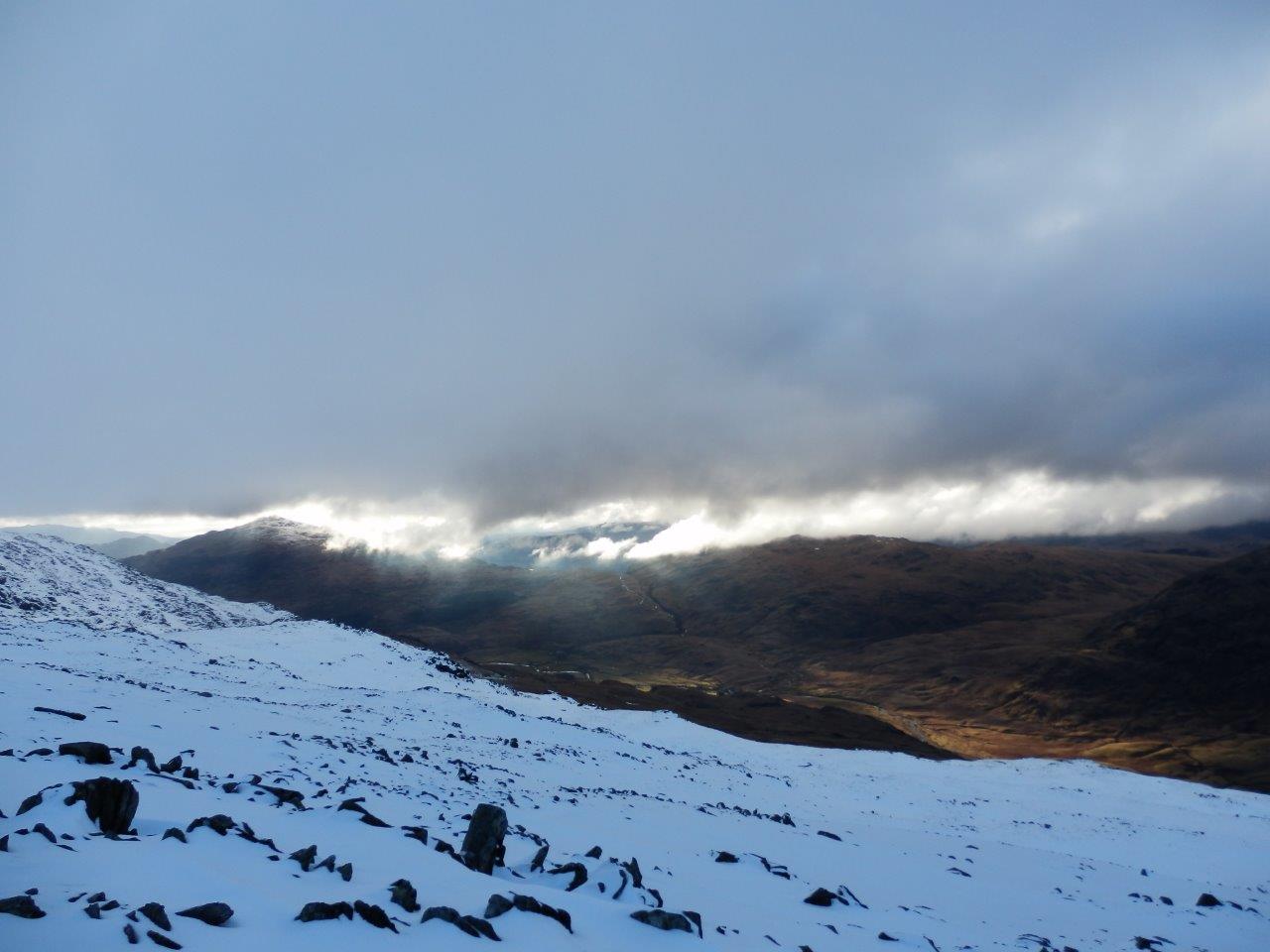
The effort involved in the descent from Great Carrs and the look of the conditions straight ahead over the head of Langdale had already told me that the likelihood of making it to my originally planned camp beyond Scafell Pike was extremely low. Indeed with visibility pretty poor, it would be foolhardy to attempt. The vague stirrings of an idea to camp early in either Langdale or on the way started to generate in my mind. Never in serious danger on that last descent, but conscious of the hard work walking through the snow and the concentration required to maintain that safety, I didn’t want to push it too much today. As it was I’d had to work harder than expected yesterday afternoon and was still feeling the effects – quite usual for me on the second day of a trip, with trip fitness not yet kicked in. The decision was to climb up to Red Tarn and assess the situation.
I began the walk up to the tarn, alternately following meandering footsteps (some of which I now realise must have been sheep dragging their feet) and the natural lines between the outcrops. After what seemed like ages the suggestion of a darker patch showing amoungst the snowy wilderness heralded the approach to the tarn itself. I took a rest by a rock outcrop and looked up and around me. I could just about see most of Pike o’Blisco, but it had never been my intention to go up there. To my left the top of Cold Pike was hidden in cloud and the start of the Crinkles only dimly showed through. Ahead the sweeping ridge of The Band plunged into Langdale from left to right and intermittently I caught glimpses to the Langdale Pikes behind.

To be frank I’d had enough for the day, even though it was only lunchtime, and with no apparent change in the conditions, I was happy to have a short day, even though it would put me fully 24 hours behind schedule.I decided to head north in the direction of Langdale and find somewhere to camp on the way down, aiming for a reasonably sheltered spot that would avoid too much re-ascent tomorrow but which would still be far enough down in case I wanted a more complete escape. I headed down the vague suggestion of where a path might lie and started following Browney Gill. Below me the view to the valley floor appeared just as I espied a flattish spot alongside the gill. I went and stood on the patch and had a good look around. The attraction of running water and not having to melt snow featuring heavily in my deliberations. I looked at my watch – 2pm – which was seriously early to be making camp. But the spot was sheltered and away from the main path. Two people, the only ones I saw all day, passed me over on the path heading for the valley. I made my decision and started making camp by the gill.
With an abundance of water, the afternoon was one of hot drinks and catching up on some reading. What breeze there was disappeared with the coming of nightfall and I settled down for the long night ahead.
Day 3: Monday 18 March
Once again fresh snow came in the night, lying heavily on the tent and a noticeable amount blowing inside to lie on the inner. Wisps of cloud drifted across the surrounding fells as I struck camp and began the ascent through the snow diagonally across the face of Cold Pike in the direction of Great Knott, one of my outstanding Nuttalls. I hacked my way upwards following any signs that suggested where the path was, frequently striking directly uphill when I spotted a more likely contender. This also had the advantage of giving the gill running down from Great Knott a wide berth, as the ground fell away steeply there and I didn’t fancy having to arrest a slip in that area.

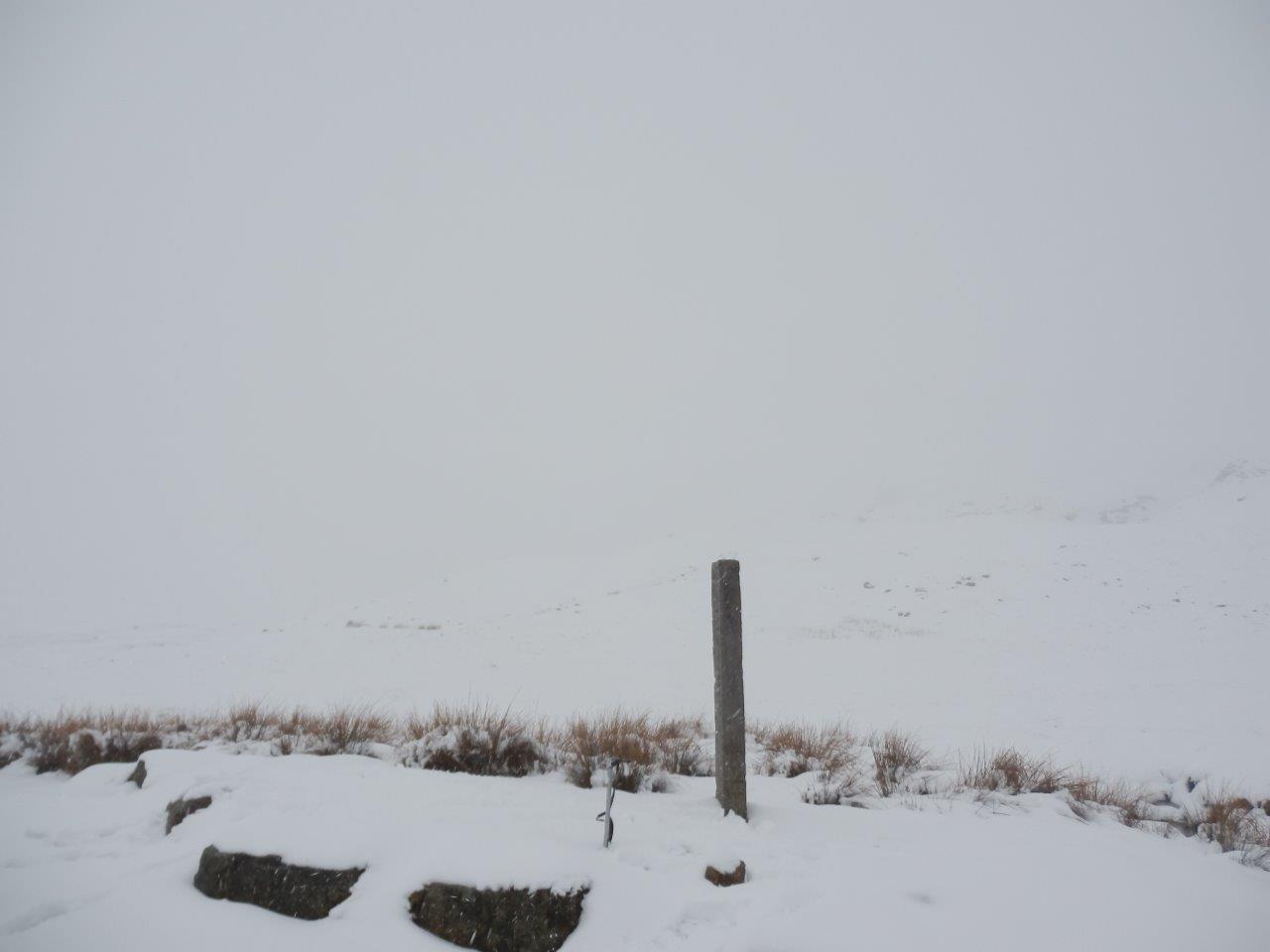
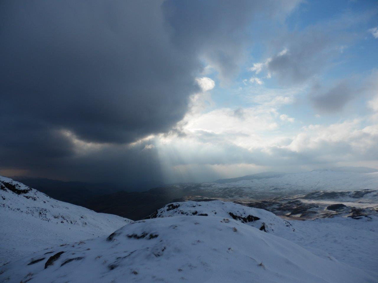
The odd cairn and on one occasion a solitary fence post gave me comfort that I was following vaguely the route I intended, although mostly I forged my own way through the snow, developing the trick of using patches where grass showed through like stepping stones to avoid the unseen deeper snowdrifts. The cloud cleared and behind me I saw Pike o’Blisco and the Langdales. Cold Pike loomed out of the mist and sat serenely watching my efforts. I plunged down a snowdrift to cross the gill and then I was on the final climb to the top of Great Knott. I staggered to the summit, touched the cairn and immediately dropped down into the lee of the rocks for shelter whilst I considered my next move. Little Stand teased me with sudden appearances through the mist, but apart from that all was cotton wool around me. This didn’t feel like the time to be navigating across the Crinkles – at my pace it would be a long day with no guarantee I’d make it to a reasonable camp spot before nightfall. So I made the decision to go back down. I was already over 24 hours behind schedule, and concluded that I would simply amputate part of my route – which was in the main part I’d done before anyway. But which way ? I could cut the corner off my route down over Little Stand, but this didn’t feel like the time to be taking a route I’d never seen before, so retreat the way I’d come was the more sensible option.
I followed my own tracks back down to the tarn, noting how they were already starting to get snowed over, and in quite a short space of time I was back down. Lunch on a rock gave me the opportunity to flesh out the next steps – I’d head towards Eskdale from the Wrynose Pass and decide on the way what to do based on what I could see. I followed a meandering route down to the Three Shire Stone, based largely on the courses of the streams running down to the pass.

The Pass looked different today. For a start where yesterday all had been white, now there was a dark ribbon of tarmac cutting the white expanse in two. And secondly there was a human at the stone. It turned out he’d seen me up at the tarn and had been watching (and presumably laughing at) my progress. We chatted for a few moments and then he set off for the return walk to his car in Langdale via Blea Tarn. Having made the grand total of about 8 miles distance on this trip so far, I opted to improve this statistic with a bit of road walking, heading west down on the road towards Cockley Beck.

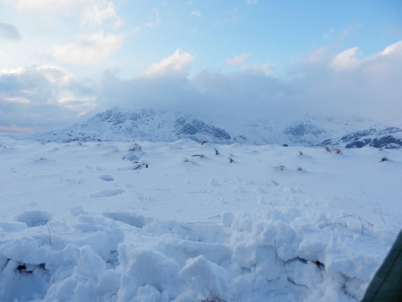
Forty-eight hours since I’d last walked crampon or spike-free and my feet loved it. I settled into a strong rythym and started to enjoy the process of walking again. Whilst I love the sight of snowy fells, walking on it is hard work. Ahead of me Harter Fell and Hard Knott showed themselves, the road twisting and turning its way up to the gap between them. I weighed up my options as I walked – the two strongest ideas being heading for Harter Fell to pick up where I would have been on Wednesday morning according to my original plan; or to aim for a camp on Hard Knott which was my plan for Tuesday night. Both would recover me some time in my walk plan, which I would need in view of my pace so far on snow. The Hard Knott option felt like it gave me more options, and I headed up Moasdale to sneak up on the fell from behind. I struck out along the bridleway, the novelty of actually following a path very apparent to me. The head of Eskdale rose up in front of me as the path petered out in the snow, and I looked up and to my left at the tail of Hard Knott.

I decided to cut the corner and head straight up the fell, stomping my way uphill and arriving bang on at the cairn at the northern end of the ridge. I’d planned to camp somewhere around here, and seeing the view of the Scafells, I stuck with that. But the wind was making itself felt, and I hunted amongst the outcrops for the optimal combination of view and shelter.

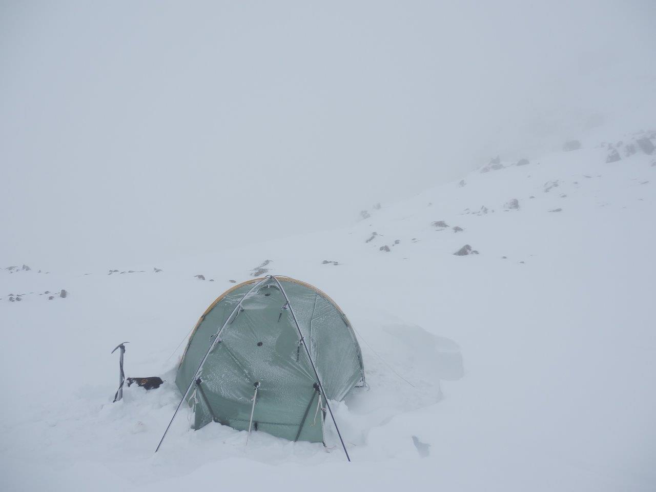
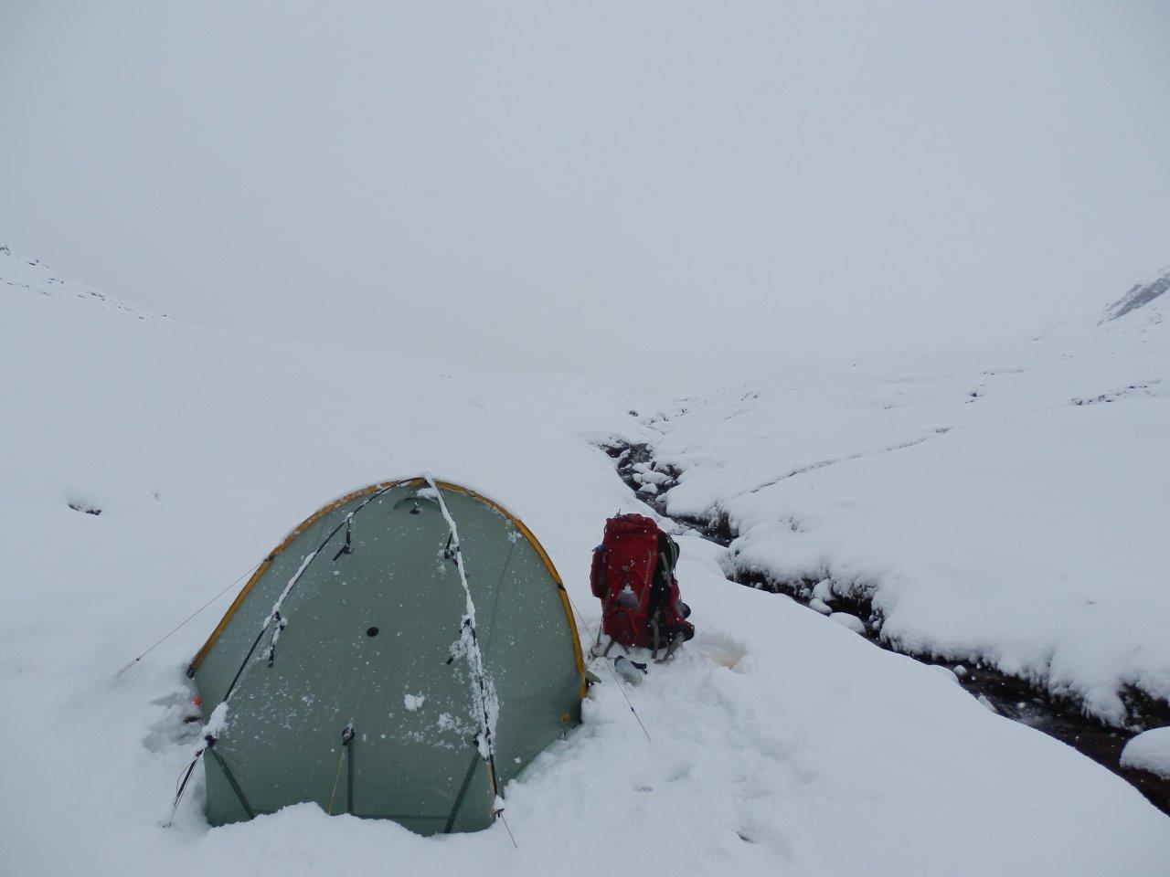
It took ages to pitch camp due to the combination of having to dig to find ground to peg into, dealing with the strong wind, and Monica being cranky and wanting to pitch crookedly. Worse the two centre end struts seemed to have come out of their velcro sleeves and despite being put back in still seemed to be standing awkwardly. With the strength of the Scarp really being in the ends of the tent, I didn’t want to enter into a windy camp with weakness here, and so experimented with using a pacerpole at each end to reinforce the centre struts. I slanted these in inside the flysheet in such a way that they would stop the centre struts moving about, and this worked well – not a sign of movement from either end of the tent all night.

I’d never have pitched here without the experience of last year’s windy pitch at Small Water, and was glad I had because the view of the Scafells was fabulous – what I could see of it anyway. I just needed the cloud to lift a bit and it would become stunning. Of all the 6 pitches I had planned, this was the one I had been looking forward to most.
Concerned about fuel and knowing I’d have to melt snow, I focused on a big mug of tea and reducing my biscuit and chocolate supply for dinner tonight, rather than tucking into my planned dehydrated meal.
I lay in my sleeping bag nervously watching the tent flexing and straining under the force of the icy wind blowing down from the head of Eskdale, hoping it would hold as it was now too dark to shift camp to somewhere more sheltered. Memories of a past windy camp came back to both haunt me and at the same time boost my confidence that my tent would hold
The wind rose further and pounded the tent, the central arch starting to gyrate as if to music, but the ends of the tent standing impassively immobile. Despite the intense cold it had involved, I was glad I’d invested the time and effort in getting a secure pitch, driving pegs into the frozen ground as fully as possible, and tamping down snow on top. As the day faded, I watched the wind battling to gain the upper hand, throwing itself futilely against Monica, and headed of to the land of nod.

Day 4: Tuesday 19 March
Something woke me around 1am and I think it must have been a sudden lull in the wind’s efforts to destroy Monica. It could also have been the gradual sensation of the cold penetrating from beneath me. Air had escaped from my mat, and neither topping it up, nor lying a blanket and coat under me made much difference. Rolling over gained a few moments respite and I tossed and turned my way to daybreak. By now the wind had, so to speak, got it’s second wind and as I unzipped the inner, found the porch full of the fluffy stuff. My boots looked like they’d been wrapped in Santa’s beard, the spare melted snow I’d left in my Trangia pot was now looking more like a frozen tarn, and the various tools I’d left out there required exhumation. All of which could wait until I’d complete my lie-in. But eventually I couldn’t put it off any later, and set-to to transforming the porch from a snowdrift into a usable space again.

I emerged to the new snowfall, pulling on my outer layers in the biting cold and tunneling my way out through the snowdrift surrounding Monica to inspect her sorry and bedraggled state after a night standing up to the Lake District winter. She lay forlornly amidst the remains of the snowdrift. She’d fought the wind all night and won, but looked tired and bedraggled, shivering and crispy with ice and snow. I packed her away with a promise of a kinder night next.
I set-off through the fresh snow heading for the Birkett of Yew Bank, one of many rocky snowy outcrops on the way to the main summit of Hard Knott. Half an hour’s trudge brought me there, suffering from my typical “first hour slowness” on a day’s walk.

The main summit of Hard Knott itself, proved a greater trial, and an hour and a quarter after striking camp saw me complete the half mile walk from camp at the cairn there. Ahead of me Harter Fell rose snowily whilst off to the right Green Crag and the Yoadcastle group of outlying fells sat with a lighter dusting of icing sugar. In the distance, a patch of glacial blue denoted Devoke Water, a favourite tarn.
As yet undecided on the bigger picture of today’s plan, one thing was clear – trudging through snow was beginning to lose its novelty value. So continuing the route over Harter Fell started to lose its appeal. It looked along way and a snowy long way at that. I decided to descend to Hardknott Pass and head along the road while I let inspiration come to me. Anything from a wild camp at Devoke Water to a night in the youth hostel was on the table.

The descent to Hardknott Pass was horrid. A confusing enough fell in normal conditions, in snow and without paths or footsteps to follow and it becomes a serious challenge. Trial and error became the name of the game as I first struggled to find a safe-looking way off the summit of the fell itself then stepped through an unfrozen bog. As slime filled my boots I concentrated on trying to find the route through the outcrops to the magic way down below Border End. I came across a gill running south-eastish that looked vaguely familiar and started following it, looking for the point at which Wainwright’s recommended rake would deliver me to the Pass. I never found it. By the time the beck’s familiarity ran out I was already quite low, although still nowhere near the road. To my right the ground looked tricky, and so I persevered with descent by the beck, striking right as soon as it looked safe to do so. What I wanted to avoid was landing at the road too far to the left and having to reascend to the pass. But at least I knew that, sudden steep plunges aside, the beck would get me down.
With the road in sight and tantalisingly close, I found myself at a tree-lined ravine, that was clearly Hardknott Gill. Twenty feet below ran the gill and then it was just a simple scramble back up and a hop skip and jump to the road. But getting down that 20 feet without losing my footing suddenly seemed a lot more difficult. My crampons clanged against rock as I inched my way down, stepped over and leapt up the other side. Seconds later I was sitting on a roadside rock gathering my wits.

Only one thought was on my mind now – staying safe now I’d got myself safe. I climbed up the 40 or so metres of height needed to the top of the pass and headed down the other side along the hairpins, remembering the effort involved in climbing up them on the day I first visised Hard Knott. The attraction of a night in the youth hostel (and especially a meal and a pint) grew as I descended, and I spent the rest of the walk worrying that it would be (a) not open, or (b) full. I arrived at the hostel to find it apparently deserted but with no signs to suggest it was shut. I let myself in to wait out reception opening, availing myself of the kitchen facilities to make a cup of tea. Now my biggest concern was finding out when reception opened at 5pm that I couldn’t, for whatever reason, stay the night, as that would realistically be too late to make much progress to a wild camp spot. Reason said that being winter there must surely be room (after all I visited that hostel in July and got a room to myself), and that ultimately proved to be the case.
Day 5: Wednesday 20 March
I woke feeling dreadful, the result of a headache induced by an absence of coffee the day before, sitting too close to the lovely hot log fire last night and a rubbish night’s sleep. But I had no excuses about snoring from the other dorm occupants, as I’d had the room to myself just like last time. Nurofen killed the headache and breakfast sorted the rest out. With a second night in the hostel also booked, I had the opportunity to go for a lighterweight walk today, and I seized it gladly. It was, however, to be a rather long walk.

I headed for the Woolpack Inn and the path leading up onto the fell beside it. 125m or so of ascent got my legs going and also brought me to Eel Tarn, a lovely place with a backdrop of fine mountains. Next I thwacked my way across the moor to cross the beck and climb up onto Boat How, an outlying fell that I’d missed when last in this area.


Standing in the wind, snowy views of Scafell and back to Harter Fell and Green Crag revealed themselves, and I wondered why I’d not put in the few extra minutes effort to climb up here back in July 2010 when I’d passed on the path below.

I descended down to Burnmoor Tarn in a biting wind that felt so much colder today having spent a night in a nice warm hostel rather than an ice-encrusted tent.

At the head of the tarn I struck off to find evidence of the path that supposedly climbed up onto Illgill Head. The steep ascent was made trickier by reaching the snow line, but I continued slowly and more carefully to the top, glancing right every so often to enjoy the view of the head of Wasdale opening up. Kirk Fell, Great Gable and Scafell in particular were heavily laden with snow and once again I was thankful that I’d decided to cut out the Scafell part of the route.

I carried along to Whin Rigg with spikes on my feet, staying away from the points where gaps in the ridge revealed the plunge down the screes to Wastwater below, and enjoying the myriad of frozen tarns strewn either side of the path. I reached Whin Rigg and carried on down to Irton Fell, pausing briefly to remove spikes when the snow ran out. As the path from Mitterdale Forest crossed the ridge, I recalled a backpack in 2008 which had seen me take that route into Wasdale at the start of several days of unrelenting wind and rain.


Ahead, a small pimple rose out of the trees, indicating Irton Fell, the second outlying fell of the day. I walked through the trees, emerging on the summit mound to a surprise – the view back up Wasdale.

Less pleasing, however, was the steep and precarious descent off Irton Pike to the road, but it was at least short. Unlike the 6 mile slog along the road back to the hostel which followed.
Day 6: Thursday 21 March
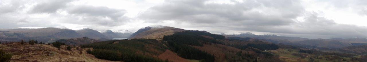
The sun came out and let me get a good look at the fells today, in a last shot of ok weather before winter resumed with a vengeance. Due to leave the Lakes on Friday, my plan today was simple – get as near to, or better still all the way to, Coniston, so as to give me an easy journey out. So first I checked that at least one of the Coniston hostels had availability, as having got Monica dry I fancied keeping her that way rather than take her dripping to the weekend meet-up in Wales. Then I set off for the climb over to Dunnerdale.

Snowy tops of fells poked above dark and autumnal looking lower slopes as I took my last look at Eskdale. I huffed and puffed my way up to Spothow Gill, feeling the extra weight after yesterday’s lighter load and the effects on the feet of my longest walk of the trip.

To my left Harter Fell looked down on me, it having been a sentinel over my progress for pretty much the whole trip so far. Green Crag, still flecked with snow, lay to my right showing what could have been – a favourite fell that I’ve been wanting to spend the night on for a while.

I reached the start of Dunnerdale Forest and slipped and slithered my way down a mucky path decorated with patches of frozen crystals amongst the unkempt trees leaning over the path. In the distance trees were falling as I said goodbye to Eskdale for another trip. Dunnerdale doesn’t seem that impressive on the map, but took surprisingly long to cross, involving two river crossings over stepping stones, a descent on wet leaves through the woods and a slog along undulating roads.

I arrived eventually at the bottom of the Walna Scar Road with 400m of ascent and 4 miles of walking standing between me and the end of the walk. Knowing this would be a slog, I mentally broke it down into 25m blocks of ascent, counting down from 16. I reached the snow at 8 with the wind strengthening and felt the need to use my microspikes to help ensure I stayed in contact with the ground. With two blocks to go, I met a couple coming the other way who asked me if there was a way along the bottom of the fells back to Torver. The answer is clearly yes, but at the cost of 6 miles. The wind had worried them coming over the crest of the ridge and they didn’t really want to return the way they’d come. I suggested they return that way and that they act as a windbreak for me. They weren’t impressed, but despite giving me a head start, they soon found themselves overtaking me and deflecting the worst of the wind from me. Even so I practically crawled over the crest of the ridge.


Now just the relatively simple matter of a descent on a good and obvious path, even in the snow and I made relatively short work of it.

A school party greeted me at the hostel, and I found myself put in a room at the opposite end. A few short hours later, and the school party had bailed, having seen the weather forecast and deciding to start from home before the threat of heavy snow materialised. 5 guys bunched up into one room, now unnecessarily.
Day 7: Friday 22 March
The words “es hat eingeschneit” alerted me to the accuracy of the previous night’s forecast, and the fact that 2 of my dorm mates were not from these shores, and making it three nights out of three that I’d shared a hostel with Germans. The drive of Holly Howe hostel had disappeared under the snow and the sky was heavy and grey. The mountain weather forecast was predicting 80 mph winds, in contrast to the, difficult enough, 30-35 mph winds of yesterday. As I lay in bed catching up on several days of social media, it quickly became apparent that the follow-on trip to meet up with Nina, Fiona, Kate, Andy, Chris and Phil was a dead duck. Snow on the hills in Snowdonia not a problem as such, but getting to them very much so.
I left the Germans bemoaning the fact that they’d left their waterproof trousers back home in Cologne as they contemplated their planned walk over to Eskdale – the exact reverse of my previous day’s route. I didn’t envy them the walk given the fresh snow, continuing snowstorms and vastly stronger winds today.
I got myself going and down to the bus stop, unsure as to whether a bus would actually turn up. Conflicting views from a staff member at the hostel and a local made me none the wiser and I stood in the bus shelter to wait it out and see if anything turned up. It didn’t. I set off to walk to Ambleside, or possibly only as far as Hawkshead as there was a chance that the bus would run from there. I made my way along the icy lanes where anyone with a 4×4 was out showing off. I slogged my way up Hawkshead Hill, the obstacle that grounds the buses in these conditions and debated dropping down to Hawkshead versus sticking with the walk to Ambleside. A lorry had ploughed off the road into a wall, and the driver stood a little way further on to warn others while he waited for help to come. At least I could keep warm by moving – he looked frozen.
I covered the distance to Ambleside without significant breaks other than to step out of the path of 4×4 dickheads, and that aside started to enjoy the mechanical process of walking. I arrived in Ambleside and the trip was done.

A gripping account. Great read.
LikeLike
Great stuff
LikeLike
Great post, and great photographs!
LikeLike
Great read mate ..well written wish I could be bothered to write trip reports .The snow and wind make for long days don’t they 🙂
LikeLike
They sure do. Or in my case short days when I expend all my energy on a very small patch of snow!
LikeLike
Thanks for your kind comments everyone. It was one of those trips that will stay in the memory for a long time.
LikeLike
Great account! Trips like that are always about decisions to some extent or another aren’t they? And the ability to make those sensible decisions and not just plough blindly on, is a very necessary skill.
LikeLike
Yes indeed they are. My longer trips always seem to involve some sort of change of plan, be it due to weather or my physical condition. So I never really expected to complete my full planned route, but I do find that having a planned and researched route makes it a lot easier to judge the impact of any changes I make along the way. On this trip I expected some snow, but not quite as much as I got!
LikeLike
I followed your progress on Social Walking and it was good to be able to relate this to your blog. I think that the YHA’s were a good idea given the weather conditions.
LikeLike
They were, and with a bit more foresight I could have planned it that way. However, I really enjoyed the camps themselves and it wasn’t really them that made me dive for YHA – it was more the difficulty in making progress on the walking and the fact that my walk plans no longer suited the conditions.
LikeLike
The real thing!!
LikeLike
sounds & looks like an absolutely amazing trip!
LikeLike
It was. Backpacked in the Lakes many times, done winter walks, camped in winter, but until now had never done them all at the same time.
LikeLike
Well written entertaining blog. Followed you on Social Hiking
LikeLike
Wow. What a trip. I don’t think I would have stuck it out. Be interested in a post on the lessons you’ve learned. Do you think the Scarp is a winter tent?
LikeLike
Ah, you must have read my mind – the post on lessons learned is in development as I speak. I would definitely say the Scarp is a winter tent, with the one proviso of using the crossing poles, in terms of ability to stand up to the conditions. However, I do find the Scarp is not an especially warm tent (until it’s got a good insulating layer of snow on it!) compared with some.
LikeLike
Superb trip, Great read and some cracking photos.
LikeLike