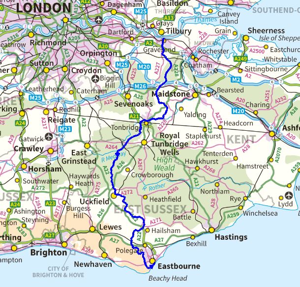
The Wealdway is a long distance path that runs from Gravesend in Kent, on the south bank of the Thames, to Eastbourne in East Sussex, where the South Downs terminate in chalk cliffs rising above the English Channel, making it the primary coast to coast walking route in the extreme South East.
The path is 80 miles long with around 7,000ft of ascent in total, so it’s a relatively gentle proposition in both distance and gradient terms. It’s safe to say it’s not one of the popular long distance paths – it’s not a National Trail, it’s not an epic distance, neither does it pass through dramatic or severe terrain, and at all times is never really very far at all from civilisation. There aren’t any up to date guidebooks for the walk either, and the best I was able to do was an original guide from 1984 by John HN Mason and a booklet published jointly by Kent and East Sussex County Councils in 1999. Clearly the popularity of this walk is not such as to warrant much in the way of up to date literature on it. And this is partly why it appeals to me.
In the extreme south east, we are fortunate to have two National Trails – the North and South Downs Ways, and a number of important regional trails including: The Greensand Way, the Saxon Shore Way, a segment of the London Loop, and the Wealdway – to name the more significant ones. Whilst the National Trails are well documented with dedicated publications and prominent marking on OS maps, they have their own route managers (there is currently a job opening for someone to manage the North Downs Way, if you’re interested), the same can’t always be said of the lesser status routes, many of which have guidebooks that are out of print, and hence involve trawling eBay and Amazon marketplace for decent second hand copies.
This would put many off walking these routes, if they get as far as even hearing of them, but this lack of information vastly increases the appeal to me: I know I’m likely to have a less-crowded path and there’s more of a feeling of adventure about such a walk without an up to date stile by stile account to follow. Were I in the line of guidebook writing, though, this would be the sort of project that would appeal to me, rather than competing in a crowded market place for a more “important” trail.
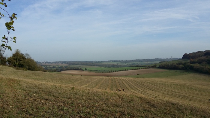
The Wealdway in particular holds a special fascination for me. I’ve crossed it many times on walks on the North Downs between Gravesend and the M20 – this is after all, my home patch – and have probably walked all of the actual Wealdway in that area. It’s always been a path that holds some mystery as it heads off southwards, while I only briefly flirt with it as part of a different walk, or use it as the express route to the crest of the North Downs. Some of my favourite places on the North Downs lie on or very close to the Wealdway. And I’ve always wanted to discover what happens on the other side of the M20…
I didn’t even consider walking the Wealdway for a while, lured instead by the brighter lights of more prestigious paths that were either National Trails or involved more challenging or scenic terrain. However, as my hiking tastes have matured, I find myself wanting to stay off the well-trodden paths of the masses, and to do a walk that is a bit more personally meaningful.
This walk reminds me of school geography lessons and having to draw the diagram of the geology of Kent, showing the dome of the Weald eroded to leave the ridges of the North and South Downs, the Greensand ridges and the High Weald itself. The walk literally walks this diagram.

Completing the London LOOP late last year also restored some faith in the walking that is to be had in the south east. For too long I’ve seen this part of the country as a poor substitute for the hilly areas, and remained blind to the fact that what it lacks in epic landscape is amply compensated for in history and accessibility. Finding places on the LOOP that could conceivably be viable for a wild camp (albeit requiring a lot more stealth than the equivalent in remoter places) helped massively in this new acceptance of the local. I still love the hills and moors, of course, but now find it a lot more possible to enjoy a local walk, and to make the most of what’s on the doorstep.
So paths such as the Saxon Shore Way (a project I’m going to do with my Dad when the weather improves), the Medway Valley Way, the Greensand Way, London Countryway and of course the Wealdway are now firmly on the to do list. Indeed, the Wealdway provides an obvious way to link up the two ends of the Saxon Shore Way, and I was going to leave it for exactly that purpose. But something is telling me to do it now.
I picked the Wealdway to do first for a number of reasons:
- It’s not too long – I didn’t want to get bogged down in a long project, mainly due to work situation.
- I wanted something that I could have a reasonable chance of backpacking and wild camping, either in a few small blocks or potentially in one go.
- The start is local – just across the river from me.
- The trail breaks down into sensible sized daily walks, that all start and end at a station or very close to one.
- It’s a coast to coast walk, so it has meaningful start and end points rather than an arbitrary start/end in a street or next to a bin.
- I feel I should walk my local paths.
- The pull of the path itself from the many years of seeing the WW waymarkers.
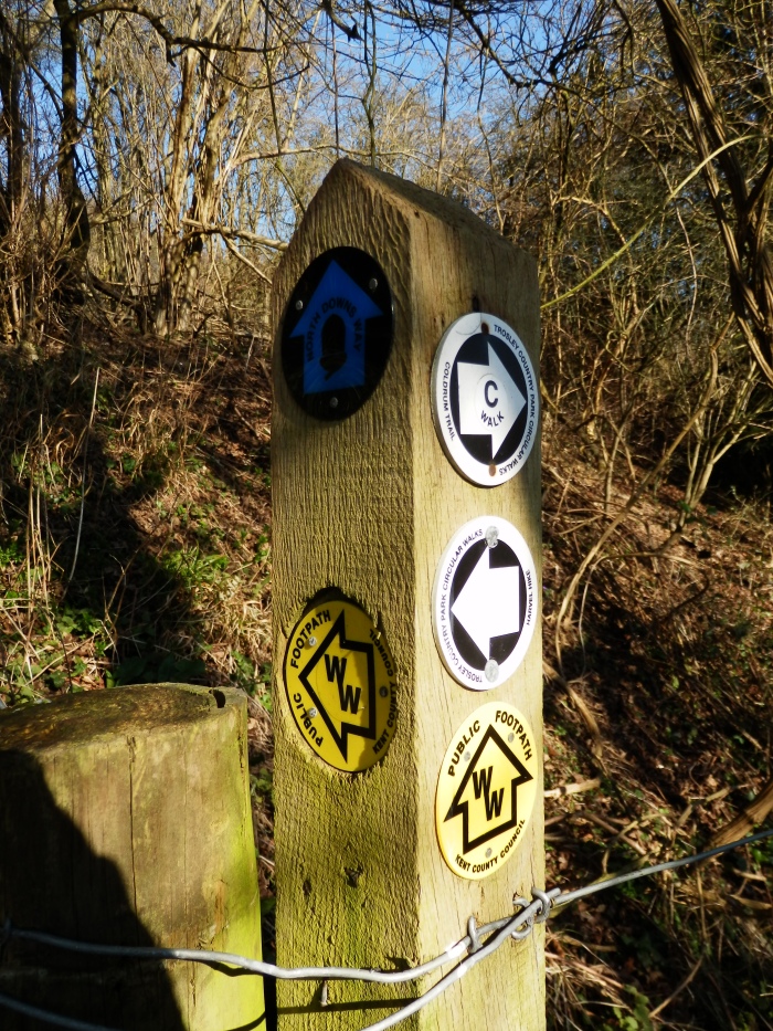
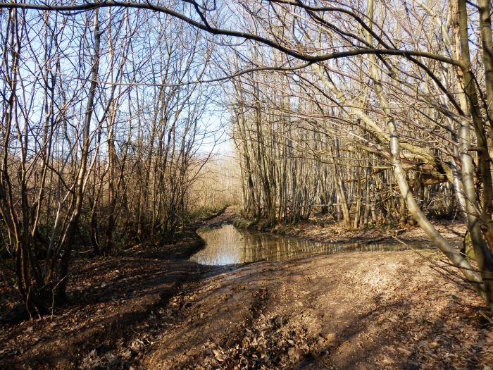
“WW” – Wealdway waymark Another plus, although not a determining factor, is that Kent County Council are one of the better local authorities for properly maintaining the network of public footpaths and signage. The contrast between South Essex where I live, and Kent where I’m from is huge. Kent welcomes walkers, Essex seems to grumpily tolerate them (at best), or quietly discourage them with barbed wire and brambles.
The Actual Planning
At 80 miles and with an ascent figure that isn’t going to cause any problems, the challenge is simply one of cutting the route into sensible daily distances and aligning these with the logistics. The most obvious way to do this, of course, is to start and end each day’s walk at or near a railway station. When I mapped the route out in Anquet, I found this surprisingly easy, and the pieces just came together without much need for deep thought:
| Section | Start | End | Approx. Distance (miles) |
|---|---|---|---|
| 1 | Gravesend Pier | Sole Street | 5½ |
| 2 | Sole Street | Platt (for Borough Green Station) | 9¼ |
| 3 | Platt (for Borough Green Station) | Tonbridge | 13¼ |
| 4 | Tonbridge | Ashurst | 10½ |
| 5 | Ashurst | Buxted | 12¼ |
| 6 | Buxted | Berwick | 19 |
| 7 | Berwick | Eastbourne | 15 |
These figures include a detour in Mereworth Woods to bag a nearby trig point, a deviation to climb over Wilmington Hill on the South Downs and the longer route option via Beachy Head, making my total planned distance about 85 miles. It doesn’t include any extra walking from the route to/from stations at the start/end of each section, nor does it include any extra walking off-path to find wild camp spots.
Additionally, there are sufficient main roads and villages lying across the route to enable sections to be broken up further if needed.
The fact that each section fits nicely for public transport also means that combining several sections to form a multi-day walk works just as well. So I may well walk this as three two day walks – sections 1-3, 4-5 and 6-7. If I do so, there look like being some reasonable camping options, both tame and wild, at the ends of the first days (sections 2, 4 and 6). Combining sections is also a good idea given that the end to end train journey to/from home is 2-3 hours because of the number of changes and having to go via London. I wouldn’t want to do that each way just for a day walk. Although, having said that, I did for the London LOOP!!
So this pretty much means I can just throw myself into the walk and do whatever sections at a time I can fit into my schedule. One thing though – I won’t be doing sections 1/2 as a whole walk by themselves – that part of the route is too familiar already, and I walked it back in October. So the first part has to be a multi-day walk: Gravesend to Tonbridge.
I’m now just waiting for a reasonable forecast and a suitable time window to present itself to get on and do the first chunk.
I’m really looking forward to this.
Mathew. Like all your other posts, I am particularly looking forward to reading this series. My cousin lived in Kent and my Aunt & Uncle lived in Crowborough.
LikeLike
Probably not as much as I’m looking forward to walking it though 😉
LikeLike
Look forward to reading the updates on this route. I agree regarding Essex footpaths being poor and having unnecessary obstacles put in your path. Also be interested to see what wildcamping spots you find as they’re also hard to comeby in Essex. Enjoy the walk!!
LikeLike
How are your plans for Weald Way going? We are planning to do it in June in one go,wild camping overnight. Hope you get to do it
LikeLike
Quite well, as I finished the walk in December 2015! Here is the write-up: https://hillplodder.com/category/long-distance-walks/wealdway/
My plan of doing it a series of 2 day walks with wild camps worked well. I can see I might repeat the walk some day, any maybe try to do it all in one go. If so I’ll probably do it in reverse to make it feel different.
LikeLike