
[Planned route, excluding FWAs, in blue. Actual route in red]
For 2025, I chose the little-used start point of Ardrishaig – this year only 5 out of the circa 300 starters used it. Now, I’m still relatively early in my Challenge “career”, and haven’t yet exhausted the more popular start points, so why pick Ardrishaig ?
This goes back to my road trip of Scotland in 2023, when I took a year out from the Challenge. That trip took us up the east side of Scotland, over to Orkney and back, and then down the west coast. We finished up exploring south of Oban, and in particular the prehistoric remains around Kilmartin. Throw in the Crinan Canal and it was somewhere I wanted to go back to. A friend also did the Ardrishaig start last year (2024) and it frankly made me envious. So there was little doubt that I’d go with Ardrishaig for 2025.
How I planned it
Planning was a “simple” matter of solving two problems: 1) where to cross the West Highland Way, and 2) where on the east coast am I even aiming for anyway ? I added a couple more constraints in terms of wanting to include something I’d done before and liked, and had a rough idea of how long I wanted it to be (ie. long). I also had preferences in terms of the type of walking I wanted to do – whether I wanted to include any Munros, how much pathless terrain etc etc. The key one was that for a long route, a significant proportion needed to be on good paths and tracks, to ensure I covered the distance.
The first few days
Getting to the WHW yielded two main options – a route paralleling Loch Fyne, then striking over to the WHW via either Glen Shira or Glen Fyne. Or I could aim to hit it further north at either Bridge of Orchy, or scratch an itch and try to find a way to include Glen Kinglass. This latter would also position me nicely for including Rannoch Moor as my “something I already know I like” section.
All of the options apart from Glen Kinglass underwhelmed me, including too much road walking or too much pathless terrain for early on in the Challenge (I like to find my feet the first few days and not make it too extreme).
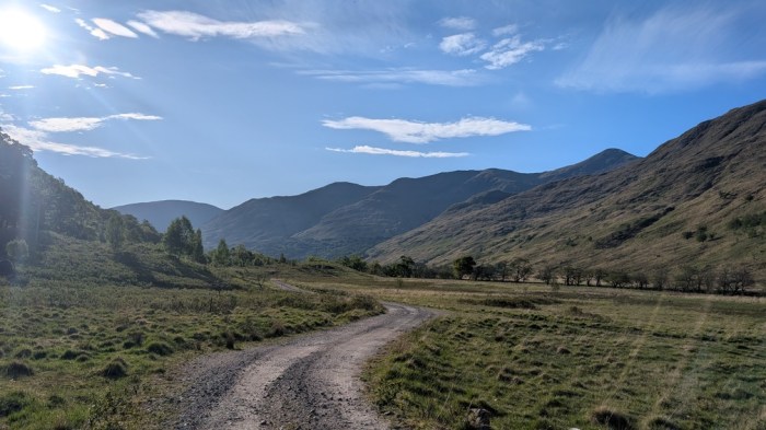
Having decided on Glen Kinglass, I then had to solve the problem of how to get there, involving a lot of northwards and very little actual eastwards progress (it would actually take me 3 days to get 25km further east than I started). Inevitably this involved a lot of road, albeit on relatively quiet roads, and I included forestry tracks where I could to get me off the roads. It wasn’t ideal, but it was the price I’d have to pay for joining up Kilmartin and Glen Kinglass, and if I was going to do a significant amount of road walking it was best placed early on anyway.

The last few days
Choosing where to finish was much harder though. With no restrictions on where to hit the coast as long as it was between Fraserburgh and Arbroath, I have built up a long list of places I’d consider finishing: the most appealing ones being north of Aberdeen and further away from public transport back to Montrose at the end – using any of those would realistically need me to carefully manage how I covered ground overall during the Challenge, given how little eastwards progress I’d be making at the start.
Ultimately I compromised by choosing Blackdog, and more specifically Blackdog Rock, which was close to a bus route and not far out of Aberdeen anyway. It was the best balance of quirky finish and practicality of logistics.
Being close to Aberdeen, this gave me the option of using the Deeside Way for some of the last section – a fast and predictable way to eat distance at the end of the Challenge, if I needed to. A sort of “get out of jail card” if you like.
Joining it all up
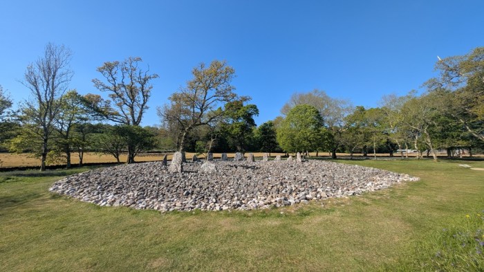
An Aberdeen(ish) finish and coming from the south meant that I’d most likely be going through Braemar and, almost certainly Ballater. I plotted a route away from the Deeside Way, that included a hill and a bit more prehistoric stonework to bookend the trip (did you know that apparently Aberdeenshire has more stone circles than anywhere else in the UK ?)
Then finally, joining Rannoch and Braemar: pretty obviously a route parallel in some way to Loch Rannoch and then up Glen Tilt would do the job, adding extra “something I already know I like” to the route.
I tweaked it a bit to maximise the off-road as much as I could, and added in some optional hills (Schiehallion, basically a whole day’s detour and Lochnaggar which I’ve had on my route card 3 times before already and never yet done).
I fixed some accommodation points at Glencoe Mountain resort (night 4), Blair Atholl (night 8) and Braemar (night 10) and then left the rest as flexible as I could.
How it went
Click on the subtitles for blog posts for each section, and on the video images for the videos.
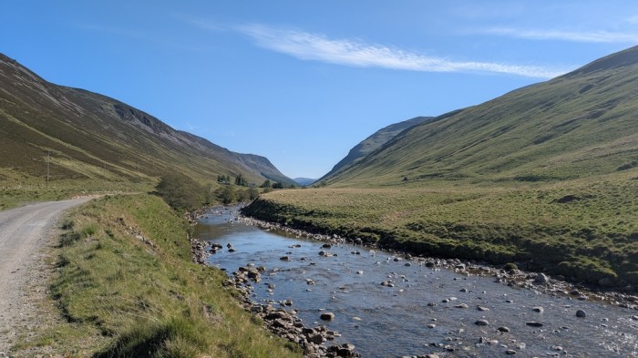
Days 1-4: Ardrishaig to Glencoe (129km, 2044m ascent)
via Crinan Canal, Kilmartin, Loch Awe, Loch Etive, Glen Kinglass and WHW
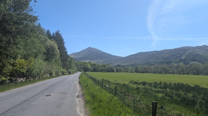
Days 5-8: Glencoe to Blair Atholl (70km, 1066m ascent)
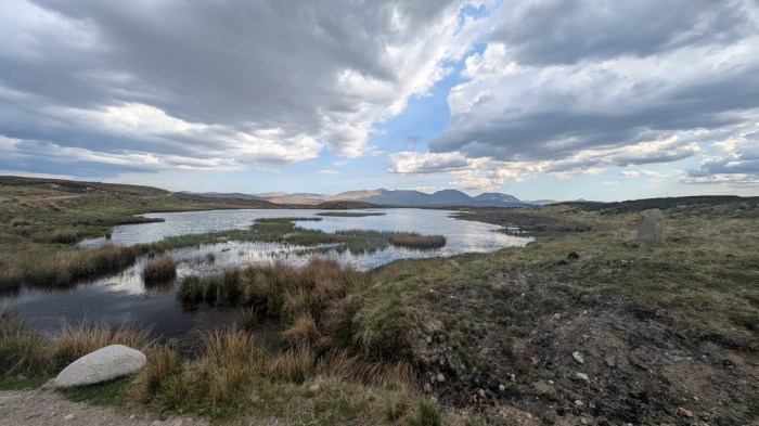
via Rannoch Moor, Loch Rannoch and Tummel Forest
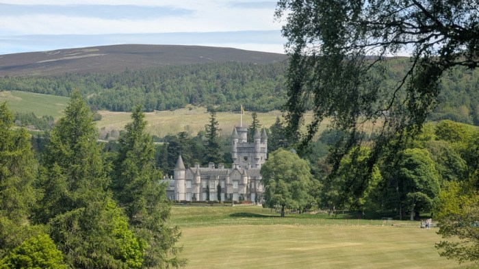
Days 9-11: Blair Atholl to Ballater (79km, 978m ascent)
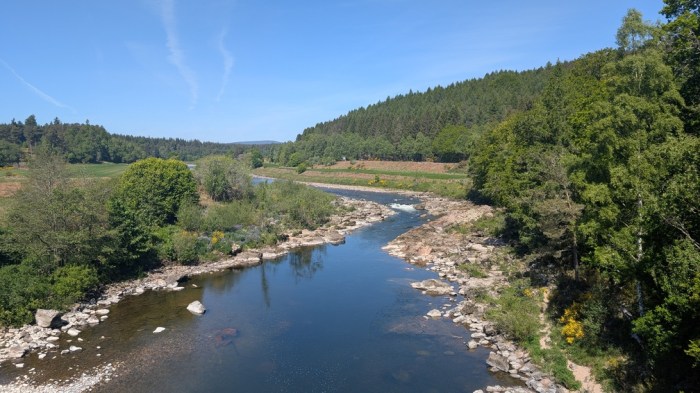
via Glen Tilt, River Dee and Balmoral
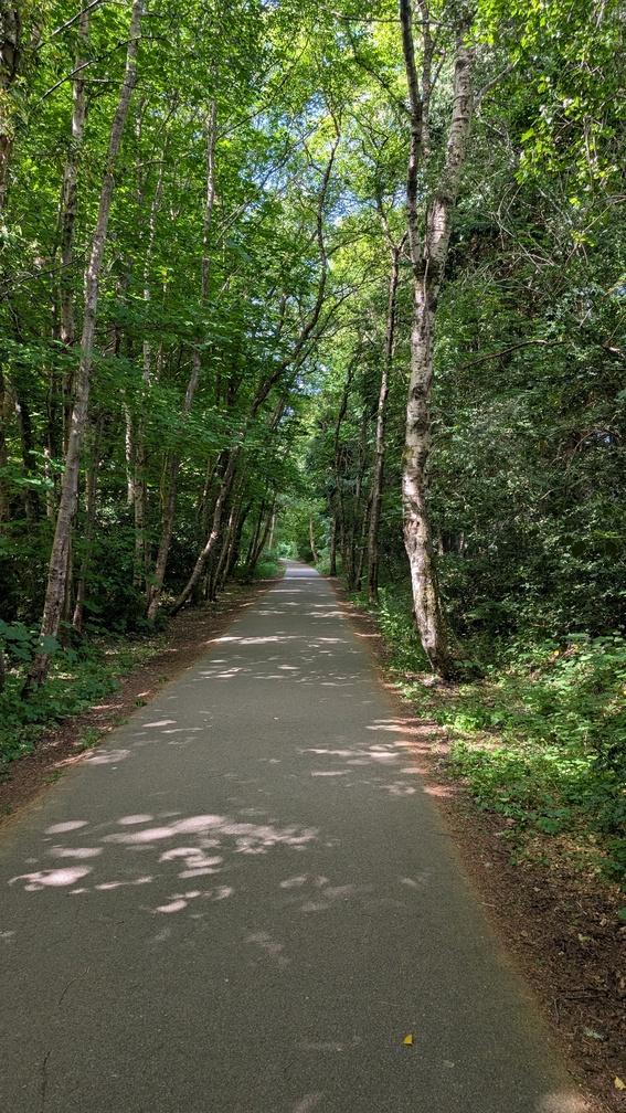
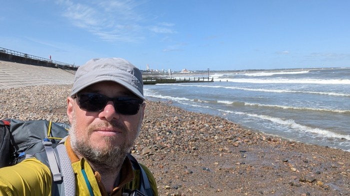
Days 12-15: Ballater to Aberdeen (83km, 590m ascent)
via Aboyne and Banchory to Footdee
Once again, like in 2024, I overcooked the first section, arriving in Glencoe just as frazzled as I arrived in Fort William the year before – albeit for different reasons. In 2024, there was a lot more rough, pathless terrain, but 2025 was a lot more hard surfaces and was, of course, hot. In both cases they were very lonely efforts too. In 2024 I was ill and re-routed after Fort William to buy me time to recover; in 2025 I wasn’t ill as such, but was suffering badly from the tree pollen and knock-on asthma impacts.
So this year, I really missed:
- Easing myself in at the start with some lighter days. I did this perfectly satisfactorily on my first 3 crossings, but post-pandemic I seem to have gone mad and tried to be “on it” from the start.
- People. I saw no other Challengers after leaving the hotel at the start, until I was halfway up Glen Tilt on day 9. This happened in 2024 too (although I saw my first Challenger on day 5 that year – and as luck would have it he was one of the first two Challengers I saw on day 9 this year).
The weather was unusually hot too, causing problems for some Challengers, but the amount of road walking I did early on yielded a lot of shade, so I wasn’t badly affected. I do wish I’d taken my sun umbrella though.
Once I reached Rannoch Moor, I settled down a bit, both physically and mentally, and I’m so glad I included that again. But things started to go awry again in Glen Tilt: my ankle and lower calves started aching, pretty much at the point the track ran out. I coped with it to the end, but simplified my route thereafter, taking out hills and adding predictability by simply following the Deeside Way all the way to the coast.
In hindsight, the ankle problem is down to several things: 1) very little backpacking carrying a load since the last Challenge, 2) marathon training putting a lot of load through my legs, and running being a very different set of stresses to backpacking, 3) maybe my original ankle injury from 2016 was a factor too. Ultimately, with a week’s rest post-Challenge, it’s fine and I was even able to do parkrun with no ill effects. It was simply a repetitive strain through lack of practice using it in that way. It has got better with rest.
Gear
I stuck pretty much to the same main gear items that I used in 2024:
- Tent: Tarptent Stratospire 1
- Pack: Gossamer Gear Mariposa
- Sleeping Bag: Cumulus Quantum 350
- Mat: Sea to Summit Ultralight Insulated
- Shoes: Altra Timp 4
I mixed it up a little with my cook system, taking a 1300ml non-stick Evernew pot rather than the 900ml MSR kettle I used last time, and giving me more option for doing “proper” cooking if I so desired (I didn’t). I bought a collapsible cup just before the Challenge and it made a big difference, allowing me to have a hot drink at the same time as eating my dinner.

Clothing was essentially as usual – Alpkit Koulin long tights with either a Rab Force Sun Hoody or Montane Dart baselayer. I actually wore the sun hoody for 14 of the 15 days, only switching to the Montane baselayer on the last day when it turned noticeably cooler. I played around with mid layers a bit, but over-catered for cool and wet weather and sent several things home. The only additional layer I wore was my Mountain Equipment switch vest (used for camp) and a Mountain Hardware Kor preshell (rescued from the “get rid of” pile, ironically) on the few occasions there was a cooler breeze or spot of rain. I never wore my actual waterproofs at all.
I wouldn’t change any of the kit, other than slanting towards the warmer weather items – but then you don’t know what weather you’re going to get over the whole two weeks. I do wish I’d had the sun umbrella, and also as conditions were so good I wished I’d had a chair to use to sit at camp – I’d definitely have used it, and toyed with the idea of getting one to try on the crossing.
Reflections on the route
Looking back, all of the things I really wanted on my route were great and just as I’d hoped. But I had to compromise the quality of pretty much the rest of the route to make them happen.
With the route choices to include the things I wanted, coupled with the need to use the “emergency exit” to the coast, I walked the majority of the Challenge on hard surfaces – roads or tracks. My estimate is approx 320 of the 360km was on roads or tracks, with very little of the rest being truly pathless. Navigationally, it was probably my simplest crossing – I never needed to look at the map, other than as a progress check.
I think I was so invested in a long route that I got carried away and took my eye off the quality. Having said this, it was all the sort of walking I tend to do outside of the Challenge, but never so much in one go! Indeed, I never do trips as long as the Challenge, and rarely as long as the 9 days it took for my injury to emerge – so avoiding a recurrence may be difficult.
Ardrishaig is certainly not the worst start point I’ve used: Ardrishaig itself is quite a nice setting, and I enjoyed the first day. However, all of the other 4 starters there went east a lot sooner than I did, and consequently had a very different character of their routes. It’s a lonely start, and lonelier with the choices I made. Probably best summed up by saying I liked the place/setting itself, but was less happy with the effect its remoteness had on my route overall.
I left myself too much hard work early on, when I stopped 13km short of my planned stop on day 1. Day 2 was about the planned distance, and I only really ate the 13km deficit by pulling out a 38km on day 3 and 34km on day 4 – days when I had less shade and really felt the heat: the last 10km along the West Highland Way was brutal. I need to plan an easier start in the future, and leave some longer days for the middle.
The middle this time felt like a rest compared with the first section, and I needed it.
My route card had a 39km day for day 12, which I ended up avoiding by not doing Lochnaggar and also not doing the FWA to Glas-allt-shiel – I did the more direct road walk to Ballater instead, giving me half a day back.
Given that the last two years I’ve walked into Braemar with lower leg niggles, I need to rein in the distance on the last chunk of the crossing too.
Looking Ahead…
The plan at the moment is to take a rest year next year, and come back in 2027 with a more sociable and shorter route. At the moment this feels like it’ll be a Strathcarron start, but I might consider Acharacle, or even a repeat of one I’ve used before, as part of another cunning and somewhat mad idea.