I was halfway down a suspiciously unlimey lime and lemonade, when a large blue rucksack came bobbing along the lane in front of the pub. It turned into the “beer garden” and Cath emerged from underneath it, and muttered some words I took to be a greeting. A few minutes later with a pint of ale in her hand, she was more coherent, and I decoded her previous attempt at conversation as being a tirade against the weight of her pack. This would become a familiar gripe for the rest of the trip.
We sat at the table and began the discussion of route options. Deep down both of us seemed to feel the original (by which I actually mean the 9th version, but the one I came on the trip expecting to do) route over Green Crag, Harter Fell and Hard Knott was a bit more than we wanted to do – Cath because of lingering issues from her Pacerpole test walk earlier in the week, and me because I just couldn’t be arsed and thought the route might be a bit testing for Cath anyway. Attention turned to where to camp tonight.
Originally, originally we were going to head towards Whin Rigg and Illgill Head and seek a high camp, but didn’t really have time to make it. The second idea of camping at the tarns didn’t look great based on my earlier reconnaissance. There was no point doing the 3rd option of heading towards Devoke Water and buying time and distance against Saturday’s walk over Green Crag etc – as we weren’t now going that way.
A throwaway remark by the bar staff about the nearby campsite which Cath relayed to me began to sound an increasingly attractive proposition – after a wild night and being out a couple of nights altogether, I was quite ready for and happy to do a tame camp. We resolved to head along the lane and take a look on our way up to the default option of the tarns. We got to the site and it didn’t look half bad. It looked even better when we saw the price was £6.50. Apparently Fisherground Campsite came in the top 50 best world campsites. You wouldn’t know it to start with – it doesn’t look anything special from the perimeter.
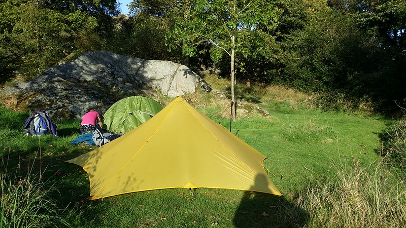
However, the ablutions hut is something else with facilities that I would class in the “too good for a campsite” bracket. A sign proclaiming that they’re cleaned three times a day too. A preponderance of firepits (technically old wheel rims) encouraging you to have a campfire and the proximity to the pub decided us. We opted for the so-called quiet corner, tucked away behind a rock outcrop. Quiet it wasn’t because it was next to the road, but it was certainly less overlooked.
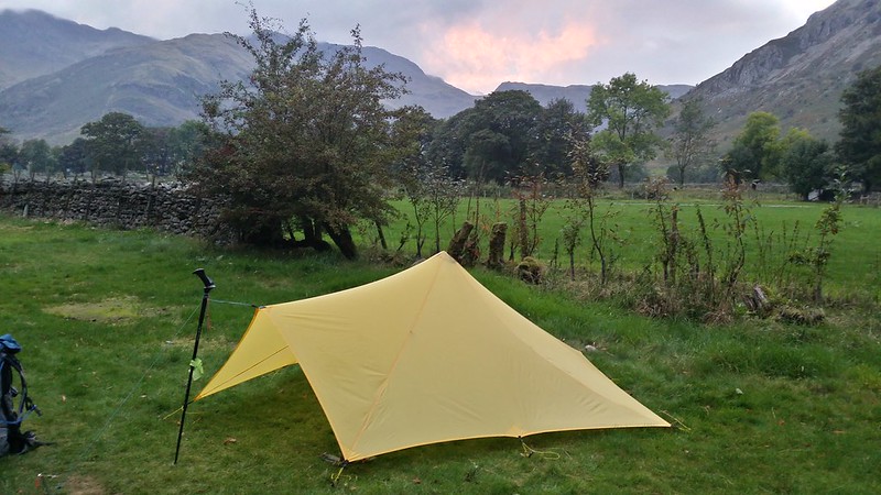
I threw up the Trailstar whilst Cath tried to remember how to erect her Apex. As it was likely to be a calm and dry night, I decided to go with the bivvy bag option again, so just dispersed my gear throughout the interior of the fly. We popped back to the pub for an excellent dinner, and then returned to incinerate the big bag of logs and kindling we’d bought from the campsite. We sat in the dark willing the wood to burn down while we lightened my pack of some of its burden of whisky.
A dripping of accumulated condensation welcomed me from the arms of Morpheus to what I would call a “blank” day – light grey/white sky but no sense of either good or bad weather. It took ages to get going and it was nearly 10am when we set off. Much of this was consumed by Cath’s attempts to pack her overly large rucksack.
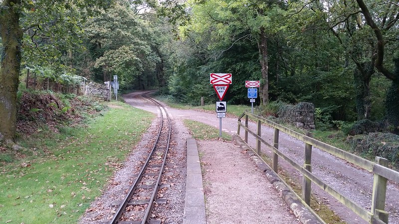
Given Cath wasn’t warmed up for the walk to the same extent as me, that she was carrying blisters and struggling under the size of her pack, we’d decided to take it relatively easy, but to remain open to possibilities. Our route took us along the road to Beckfoot station where we crossed the railway and climbed up onto the fells, destination Blea Tarn (again).

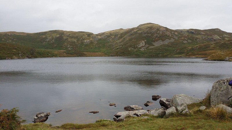
The tarn didn’t look anything like as good as it had the afternoon before, but we spent a few minutes there and I showed Cath the spots we’d have been camping at. Both of us felt we’d taken the better option. We walked on, noticing a trail of white ribbons tied to things at intervals – markers for a fell race.
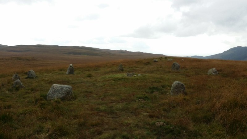
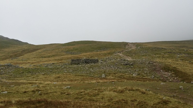
We reached the main path up onto Eskdale Moor and I now started to encourage Cath to use her Pacerpoles properly – an ultimately futile exercise as she couldn’t seem to get the hang of the straighter-armed angled pole approach required compared with standard trekking poles. I gave it up as a lost cause for now and we moved on, coming to the first of a series of small stone circles on the moor.
We walked over onto to Boat How and revealed the splendour of Burnmoor Tarn below.
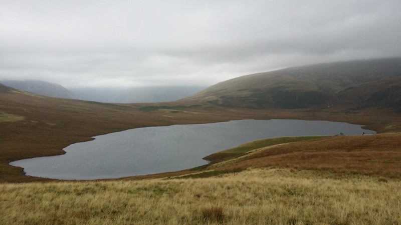
With a breeze at our backs we decided to take a lunch stop in the lee of the perimeter wall at the little house above the tarn, then carried on along the path to the other end of the tarn. Our plan now was to descend to Wasdale Head and then head up towards Sty Head for tonight’s camp.
As we walked, a couple of guys came the other way putting out markers for the Wasdale Triathlon the next day (which subsequently seems to have taken a few days to clean up causing a bit of tutting on social media).

Also as we walked the giants of Wasdale gradually emerged – first Kirk Fell straight ahead (often mistaken for Great Gable from this angle until you see the real thing), then Yewbarrow to the left and the long ridge of Lingmell.
We got down to the end of the lake and made our way to Wasdale Head through fields and across the stony stream bed. Before long we were in the pub, which was heaving with Saturday afternoon drinkers. With Cath’s feet playing up still, the idea of a low campsite was mooted, knowing that the sight of dozens of tents crammed in like sardines in a tiny field by the road would not appeal. Sty Head it was to be.

Suitably refreshed, we crossed the fields to pick up the path to Sty Head, selecting the higher level path that cuts up steadily across the flank of Great Gable, rather than the valley floor path that leaves all the big ascent to the end.

I don’t think Cath enjoyed the ascent that much, as there were plenty of protestations about feet, pack and the temerity of the forces of nature at putting scrambly rocky bits in our path. I sensed that an airport-stlye travelator would have gone down nicely at this point. Even the standard child-motivation trick of a jelly baby for every 100m ascended didn’t work.
Before long, it was over though, but not before a final round of cursing as the last bits of rocky clambering coincided with an increase in the wind scouring the more open ground of the pass.
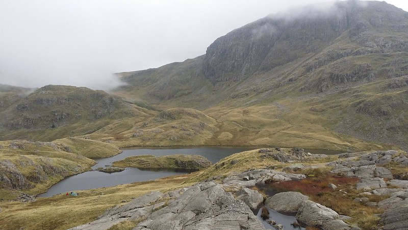
We crested the pass and looked down on the tarn. Pitch-radar activated I spotted some promising spots and kept everything crossed that we would be relatively undisturbed.

As we drew closer, I saw the tarn-side pitch I’d spied wasn’t going to happen – just back from it there was a group of 5 tents and we’d have been blocking their view of the tarn – not really fair to do that to them. An alternative grassy patch was a bit close to them, but we eventually found a spot nearer the path that also made the best of what shelter there was to be had.
By now, I was getting the hang of pitching the Trailstar, and were it not for the hard ground, would have had it up in moments. Rocks went on the corners again as a precaution, especially as the Trailstar was already wounded, and Cath has a mortal fear of any wind speed much above the power of a moderate fart. The temporary repair I’d effected at the campsite the night before now came off. I hoped we weren’t in for rain.
While Cath struggled with her pegging out, I went off to gather water.

I was in the mood for a feast tonight, and went for a 3 course meal – soup, Beef Bourguignon and the scant remains of my chocolate. We settled down for the night.

A grey morning but with a forecast improving had us up and away at a respectable time. My breakfast Kedgeree was awful and I had to force it down – won’t be getting that again.
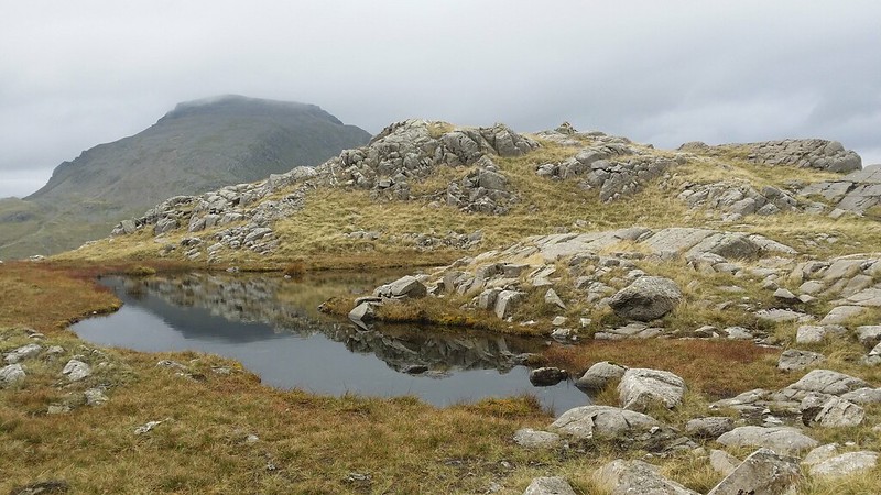
We climbed up under Great End to Sprinkling Tarn and stopped a few moments to chat with a father and daughter out for her first wild camp. We walked alongside the tarn, some tents still sat there, and moved along to the next smaller tarn. I climbed up onto the nearby outcrop for a view.
So successful was this that I repeated the process with every major outcrop we came across, working our way northwards along the fell. This also had the advantage of bagging those tops on the fell I’d not previously done, including the true summit.
Tarns abounded everywhere, and I for one took my time, drinking in the simple pleasure of just being on my favourite fell and exploring properly.
Eventually, we got to the end of the fell and the Wainwright summit, 30m lower than the true summit. A rest stop and taking advantage of the 3G signal from Keswick, before we moved on.

We made our way back over the fell, a route familiar from the 10-in-10 in June and rejoined the path up to Esk Hause. Two whole hours spent just on this one fell, a fell that many overlook in favour of more glamourous options. Every time I come to this fell, my love for it deepens still further, and I resolved to come back soon to camp among its outcrops.
The shelter at Esk Hause was busy with day walkers taking lunch breaks and we joined them for a while before setting off again for a quick out and back excursion onto Allen Crags. By now we’d sacked off the idea of doing Esk Pike and Bowfell on the grounds of feet and time, but still intended to visit the easy fells that lay so close to our path towards Langdale.
Breezy atop Allen Crags, it was now clear that the weather wasn’t going to do what the forecast had said and improve, and this helped us in our planning to take it easy this afternoon. We descended to Angle Tarn, our intention being to scope it out for a possible stay there.

A group of “youngsters” hurtled past us and seemed to be making for the tarn, and we hung back to see if they were camping there (in which case we definitely wouldn’t) or just pausing. we got to the tarn and walked around to the flat spot we’d camp at if we were going to. We took our time and had a brew up while we decided our next move.
At the heart of it was a concern at how long the descent to Langdale would take the next morning, knowing that we’d missed our planned bus the last time we did that. This and the popular nature of Angle Tarn, led us to another plan – we’d tame camp in the valley that night.
But first we had to get there, and stopped off at Rossett Pike on the way, before the long and at times tortuous descent into Mickleden.
With the descent taking longer than we thought, the sense of our plan became apparent, and the new concern became getting in at the campsite. Luckily (and as it logically should have been) it was near empty. Better still Jilly (@JillySherlock) a friend of Phil’s (@DaylightGambler) who we’d met during the 10-in-10 weekend was on duty there and this made it easier to part with the pitching fee. Best of all was the fact that the £12.50 I’d had to pay last time I was here was now a more reasonable £5.
Jilly recommended the best place to pitch (in the South West field) where a view of The Crinkles and Bowfell could be had unobscured by trees, and we headed over. A welcome shower later and we headed for the ODG and an evening of ale/cider and chilli, only leaving at chucking out time.

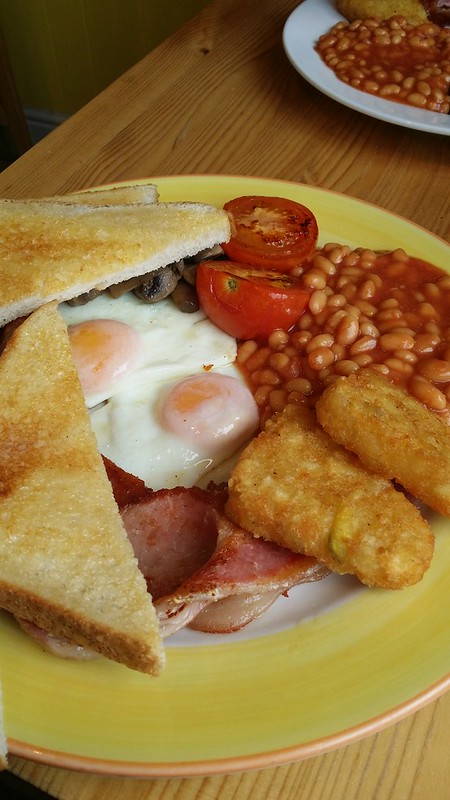
Doing all the hard work the afternoon before meant we could take it easy this morning, and we strolled over to the bus stop shortly before it arrived. Soon we were in Ambleside searching out the café we used last time we were in town for a decent breakfast to round the trip off.
Many many more photos on Flickr.
The Route (clicking on the map will take you to Social Hiking and a proper zoomable map)
