With my head now in the game, I have started to look forward to the Challenge, and this post will cover the planned route, the process that led to it, and how I plan to get to and from the start/end.
The Route

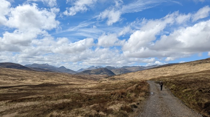
I am one of a small handful of Challengers who have opted to start in Kilchoan, on the Ardnamurchan peninsula. This is nothing new – it’s one of the less lightly used starts, and is considered (mainly by those who use it) as something of a connoisseur’s start point.
This is a start that I’ve had my eye on ever since I first started following the Challenge, but it’s one that comes with some additional challenges: how to get to the start and how to manage the schedule.
Getting to the Start
There’s two main ways to get to Kilchoan – the “school” bus from Fort William which runs once a day, or the more intrepid island-hopping route via Mull, which is what I’m doing. This requires first getting to Oban, then a ferry, a bus ride the length of Mull, followed by another ferry ride.
It’s never really been in question that I’ll take the more complicated route to the start – there’s a certain romantic appeal to island hopping, and a certain intrepid feeling from having to undergo a sea voyage just to get to the start of an adventure. Some of my best trips have started with such a voyage, although here there’s no real comparison between the Tilbury ferry and ferrying between Scottish isles. To me the island hopping to the start has always seemed an integral part of a Kilchoan start, and it would be wrong not to do it.
I’ll get the overnight coach to Glasgow, then kill a bit of time in Glasgow (ie have a long lingering breakfast in the pub), get a train to Oban and then the ferry to Mull. Once on Mull, it’s a bus to Tobermory, where I’m staying the night before the Challenge starts. I’ll do the final ferry voyage on the morning of my start day.
Now, obviously taking this approach to the start involves some risk – a ferry is more likely to be cancelled than a train or bus, so this could backfire. Mind you Scotrail have previous form for cancelling critical trains on my journey to the start of the Challenge, so who knows.
Managing the Schedule
The second additional challenge with a Kilchoan start is that it’s the furthest west start point, by a considerable distance. It will actually take me two days (although it is doable in one via a different route) just to get to Acharacle, which itself is one of the furthest west start points.

[In the above map, grey are start points I’ve “done”, dark blue are the ones I particularly want to do, and the rest are light blue.]
So a Kilchoan route adds at least a day to one’s schedule meaning that one either has to have bigger days, or shorten the route further east. A regular Kilchoan starter I know, is often the last person to finish. He’s the bloke that inspired me to do it this year. You know who you are.
Whilst the route length can be to some extent protected from this far west start, it is difficult to do so whilst still maintaining quality. The challenge of a Kilchoan start is to get both a good route and one that is just about achievable in the time allowed.
It gets worse: many Kilchoan starters don’t even head east from the start – a large proportion of Kilchoan starters head west to the lighthouse at the north western tip of the peninsula, either the day before they start, or if truly mad directly from the start. And the reason is that on Ardnamurchan lies the most westerly point of the mainland of Great Britain (no it’s not Land’s End). The actual most westerly point is about 1 mile south of the lighthouse, and protrudes approximately 125m further west. The lighthouse is a good enough proxy in practice.
These nutters then follow the north coast of Ardnamurchan for a couple of days until they reach Acharacle, itself one of the official TGO Challenge start points. Or in other words, wasting 1-2 days for nothing.
This is one reason why some Kilchoan starters deal with the lighthouse before signing out, and then head north and east from Kilchoan directly.
Starting on the later of the two main start days also serves to put me further behind the “pack”, and I’ll add the fact that I’m intending to use the full 15 days, whereas many Challengers aim for 13 or 14 days. In other words this is looking like a lonely Challenge for me this time.
Evolution of the Route
Right from the start of planning, which begun in the bar on the afternoon of finishing my last Challenge, it was a given that I’d start at Kilchoan, visit the lighthouse and then follow the north coast of Ardnamurchan.
The problem then was what to do next.
I briefly flirted with getting to Fort William, largely as I will do, then following the Great Glen Way and then cutting east along the Moray coast. Having already done the GGW, though, a better idea was to do the Speyside Way instead – same principle: follow it to the coast then along the Moray coast to Fraserburgh. This was more attractive as I’ve already decided that when I do the Speyside Way, I’ll do it from the source at Loch Spey, which is reasonably straightforward to link to from Fort William.
The advantage of a waymarked trail (although only from Newtonmore in this case), is that it provides an easy and sure way to get distance under my belt after all the dithering out west.
Ultimately, I felt this wasn’t quite what I wanted to do, so set about crafting a more normal TGO Challenge route the rest of the way from Fort William.
I started out this second iteration of planning by wanting to link up as many of the “centres” of Scotland as I could. There are many competing places for this title:
- The one the OS recognise (close to the A9 south of Dalwhinnie) – this is calculated using the centre of gravity method*, and includes mainland and islands
- The equivalent centre of gravity excluding the islands (this is just to the east of Schiehallion)
- The place where the Centre of Scotland stone is (near Newtonmore)
- a spot by Faskally cottages near Pitlochry was claimed to be the centre of Scotland in 1908
- The Pole of Inaccessibility (the point furthest from the sea)

*the centre of gravity method is most easily explained by saying that if a Scotland-shaped piece of paper were balanced on the point of a pencil, the centre of gravity is the point on that piece of paper where it balances.
After trying various ways to bag all of these, I concluded that the amount of zigzagging required was not consistent with a Kilchoan start, so focussed on a subset. So I have the Centre of Scotland Stone and the Pole of Inaccessibility on my route. I’ll leave the others for a future more southerly route.
Visiting the Centre of Scotland stone, also offered the chance to pass through a few places I’ve been curious about, as well as some bits of last time’s route I particularly enjoyed. This accounts for the whole bit from Fort William to Newtonmore.
In order to bag the Pole of Inaccessibility, I needed to cross the Cairngorms somehow, and I didn’t want to be reliant on having to go over Munros to do it – so I picked the classic Glen Feshie route, to approach it from the south. It was then an easy decision to loop around to the River Gairn and simply follow that all the way to Ballater. That had the added advantage of avoiding Braemar completely, which I found so disappointing last time out.

After Ballater, it was a question of keeping it simple, and I particularly wanted the last couple of days to be straightforward walking and navigationally easy in case I was behind schedule and needed to blitz it, so it was a simple decision to route over to Tarfside and follow the trade route to the coast.
The Final Route
So, as already mentioned, it’s north west to the lighthouse and then along the north coast of Ardnamurchan to Acharacle. After Acharacle, I’ll head to cross Loch Shiel by small ferry boat, then head up Glen Hurich and over the bealach into Glen Scaddle. It’s then a straightforward walk to the Camusnagaul ferry to Fort William. Here I’ll have my first booked accommodation, and a chance to stock up with food.
After Fort Bill, I’ll head up Glen Nevis and just follow the glen all the way to Loch Treig. Then I’ll swing by Ossian youth hostel before making my way to the foot of Ben Alder. If conditions are favourable, and I feel like it, I’ll pop up the mountain, and may even camp if it’s pretty benign weather. Otherwise, I’ll skirt (or descend) the mountain to Benalder Cottage and spend the night there – ideally a safe distance from the notoriously haunted bothy.

I then have a choice as to whether to pick off the neighbouring Munro of Beinn Bheoil, or simply take a lower route, heading for Loch Pattack, then Kinloch Laggan and Newtonmore / Kingussie. I plan on a detour to visit the Centre of Scotland stone on the way.
Kingussie is my second booked accommodation, and a chance for a more comprehensive re-stock, including hopefully a parcel.
The next day, I’ll head for Glen Feshie, and if conditions aren’t great will simply follow it by the trade route to White Bridge and the Dee. If I’m feeling perky, I have the option of a detour across another Munro – Mullach Clach a’ Bhlair.
It’s just after Mar Lodge that madness starts to creep in again. I get to Linn of Quoich and then head north west and then north east following Quoich Water and the River Gairn to Loch Builg and then all the way to Ballater, where I have my third booked stop.
Frankly, I’ll be somewhat relieved to reach Ballater, and if I get there without major short cuts I’ll be amazed. From Ballater I’ll head over to Tarfside by way of Mount Keen , then it’s the trade route to Edzell, North Water Bridge, Charleton Fruit Farm, Kinnaber Links and then finally the Park Hotel in Montrose.

The route comes out at 376km with 8,900m of ascent assuming I climb all 4 Munros and don’t take any foul weather alternatives. The distance is likely to actually come out 5-10% more due to mapping error. So if I stay on plan, I could be knocking on the door of 400km, which would be my longest Challenge by far.
But, I probably won’t do it all. I always regard the Munros as optional, but have to put them down as my main route so that the more likely lower route satisfies the conditions for a FWA. My actual default route is the low route, with the mountains being a GWA (good weather alternative). It will have to be really good conditions for me to do Ben Alder, and I’ll likely only do Beinn Bheoil if I’ve also done Ben Alder.
It’s highly likely that I won’t feel like doing Mullach Clach a’ Bhlair, or that I fall in with someone following the trade route up Glen Feshie and simply opt to stay with them for the company.
I will almost certainly do Mount Keen, unless conditions are bad – it’s no significant detour, just a couple of hundred metres of extra ascent.
Getting back from the End
In past years I’ve got the sleeper directly from Montrose, or a daytime train, but this year I’m sticking around on the Saturday for parkrun before taking a leisurely train down to Edinburgh for the overnight coach home.
In the next part, I’ll cover all the practical stuff – gear, provisions etc.