Getting to the start
As has now become a bit of a tradition, I got to Scotland on the overnight coach from London – this gives fundamentally the same journey, and even timings, as the sleeper, but for £20 instead of £70 (for a seat not a bed). The key to making this work, though, is to ensure that I have a night’s sleep before starting walking, so for my Friday start, this means travelling up Wednesday night. In any case, the logistics of getting to my start point this time, ruled out a “turn-up and start walking” approach anyway.
The coach journey was a weird one – I’d booked seat 2A, which cunningly has loads of legroom, the seat in front being a single in front of a pair, but this meant I was very close to the driver(s) and could hear everything that was going on. And there were things going on: to start with, the driver was clearly inexperienced and being supervised by someone else. Unfortunately, he took the wrong turn out of Heathrow, which can happen, but compounded it by making a series of wrong turns to get back on track. At one point he even went to pull over onto the hard shoulder of the M25 so that his supervisor could take over. Cue lots of shouting from the supervisor about basic Highway Code stuff, and the fact they’d both be getting P45s if he did that. We ended up turning around on a garage forecourt, nowhere near where we should have been. The supervisor kept up his haranguing of the hapless trainee halfway up the M1. This was not conducive to dozing on the journey.
Somehow, we were only 35 minutes late into Glasgow. I headed for my, also now traditional, breakfast in Wetherspoons (the only time I voluntarily enter one). My next bus was at 11:50, and I had plenty of time to kill and to get some gas.
Unlike 2024 when I bumped into two friends in Glasgow before getting to ‘Spoons, this time I saw no-one, helping set the tone for this year’s Challenge overall. I did however, spy a couple of likely candidates while waiting to board the bus to Ardrishaig. These turned out to be Colin (a Portavadie starter), and the lone (delayed by his flight) Thursday Ardrishaig starter, Scott. This provided some company and chat on the 3 hour coach ride.
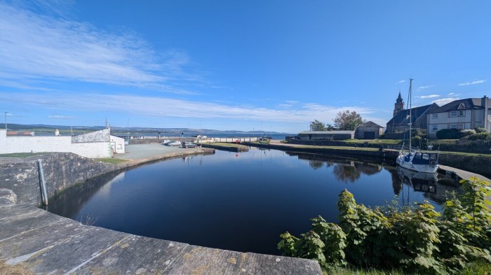
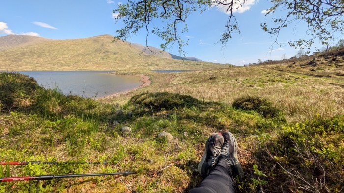
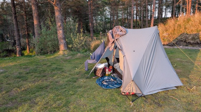
Arriving in Ardrishaig, Scott started walking, and I checked into the Grey Gull. Then headed out to explore and to capture some photos and footage to save time the next day.
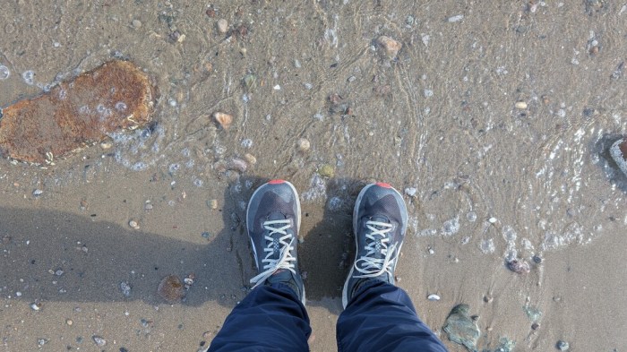
I also decided to get the ceremony of dipping the feet done, so that I could just get walking the next day – I’d just pretend I’d done it all on the same day in the video!
Day 1: Ardrishaig to Kilmartin
18.5km and 58m of ascent. Total distance so far: 18.5km
The next morning, I saw all (ie 3) the remaining Ardrishaig starters at breakfast, and that was it: I’d not knowingly see another Challenger for another 210km or so.
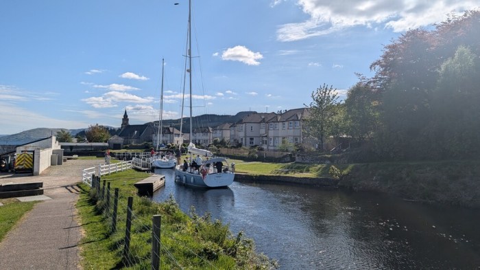
I signed out at 08:42 and set off along the canal – I may have dipped my feet the afternoon before, but I did at least start from the end of the canal where it meets the sea. There then followed 6 miles of fairly predictable canal walking to ease me in. For much of this time, I was dreaming of Polly’s Coffee Shop, a van about 5 miles in that my wife and I stopped at on our 2023 tour.
Just my luck that it was all closed up with no signs of life. The car park had a sign saying it would be closed for a private event at 11am, so I assumed that whatever event had closed the car park had also taken out Polly’s.
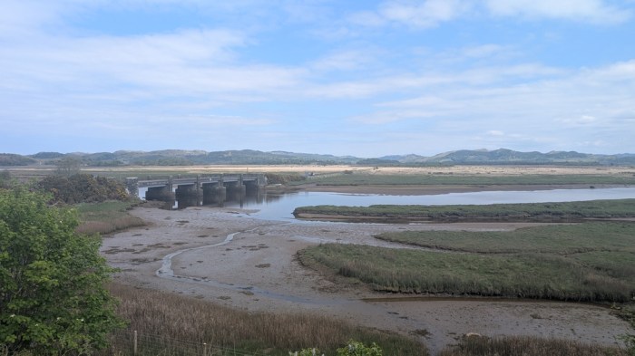
Soon after, it was time to leave the canal and head north along the road. At this point I was further west than I’d started, and would finish the day also without any eastwards progress.
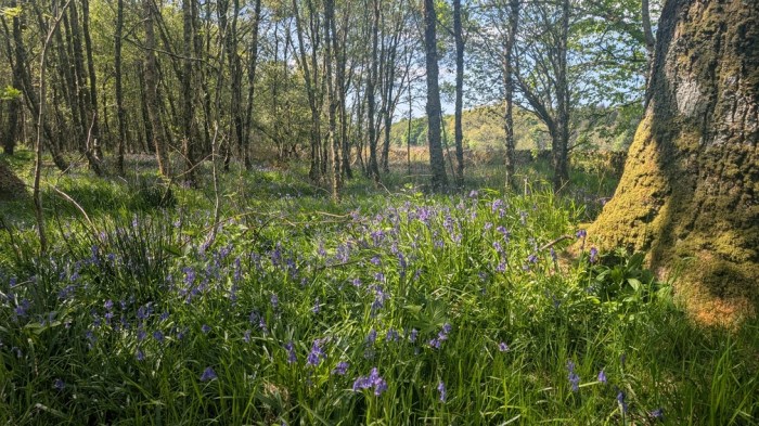
As I approached the start of the interesting bit, I noticed how prolific the bluebells were in the wooded sections. Indeed, for me this year’s Challenge was in great part defined by the overwhelming quantity of two of my favourite plants – bluebells and broom.
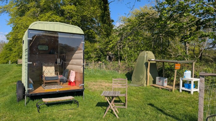
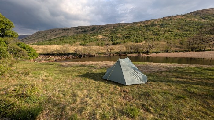
I stopped at a picnic site in one of these wooded bits, had a brew up and an early lunch. I also had a look at Google Maps, which instantly changed the character of the next 3 days. I’d looked at it to find more precise details of the route I’d need to take through the prehistoric remains, but what I actually got was a campsite marked just up the road, that hadn’t been there when I’d planned the route.
In the heat, my inclination to do another 13km to my planned, somewhat arbitrary, camp spot by the River Liever, waned significantly, and I decided to go and see what the camp site looked like.
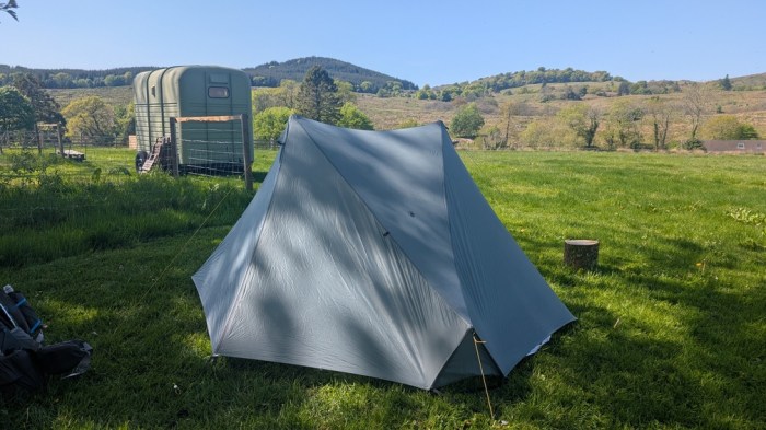
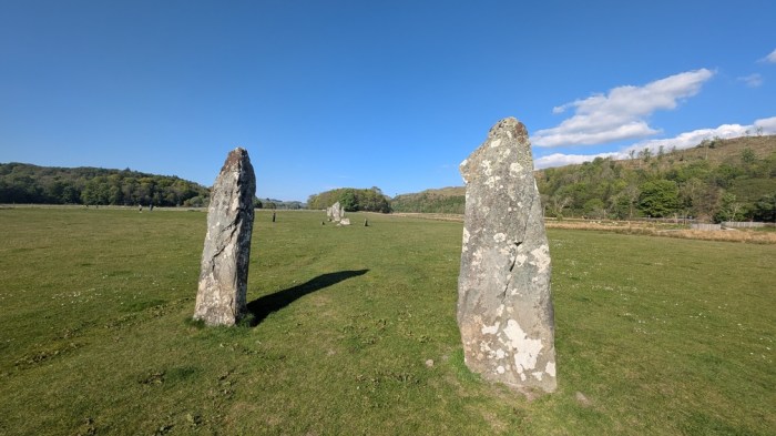
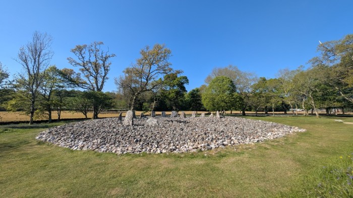
Basic. But that suited me. There was a toilet and water and even somewhere to charge things and sit out of the rain. And it was £8. And at the bottom of the hill it was on was the start of the prehistoric stuff. No-brainer really.
So I pitched up, and went to have a more leisurely look at old stones.
Day 2: Kilmartin to Loch Awe
28.4km and 482m of ascent. Total distance so far: 46.9km
I had a great night’s sleep at the deserted campsite – better than for several weeks, and moreover on the first night in the tent. Unheard of.
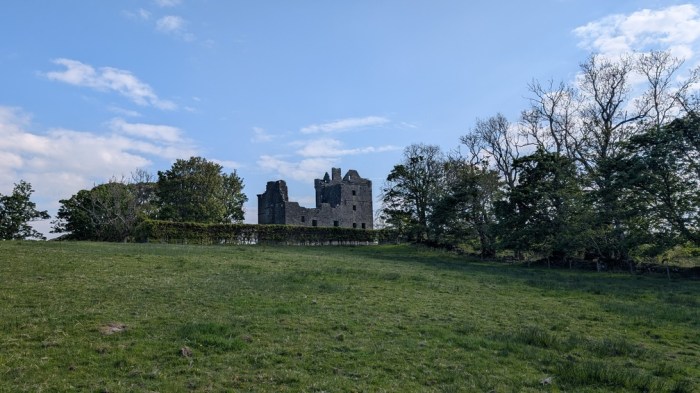
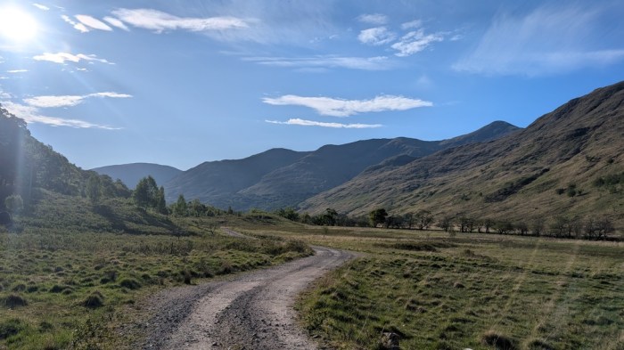
I was away for 08:35, and the path took me back past most of the stones I’d explored the previous afternoon. Then on past some quarries to the ruins of Carnasserie Castle. After I worked out how to get down to the road, I had a short dalliance with the A816, before the B840 branched off towards Ford. I had a brief rest there, but even this early in the day I was focussing on the shop/cafe at Dalavich and wanted to make sure I got there while it was open.
It was leaving Ford that a car drew up alongside me, and they’d clearly spotted my Challenge participant tag, as they stopped to chat – in the middle of the road. Turned out he was a former Challenger from some years back. We must have chatted for a good 10 minutes until another car came up behind.
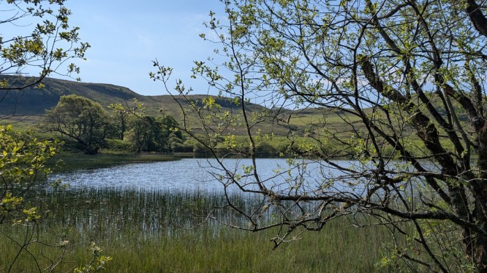
Soon I had a choice to make – whether to branch off into Inverliever Forest as per my vetted route, or to just stick to the quiet minor road alongside Loch Awe. Either way they’d join up again just before Dalavich.
It was an easy decision to make – one involved climbing up into the forest, the other didn’t. I’d have done it if I’d have been on schedule and looking for my first night’s camp spot, but with ground to make up, an easy surface to walk upon, and plenty of shade and loch views, I decided to stick with the road. It would save me about 2km, I calculated.

Turned out the road was just as undulating as going up into the forest would have been, and when I finally walked into Dalavich, I was more than ready for the promised cafe. Except that’s not quite what I got…
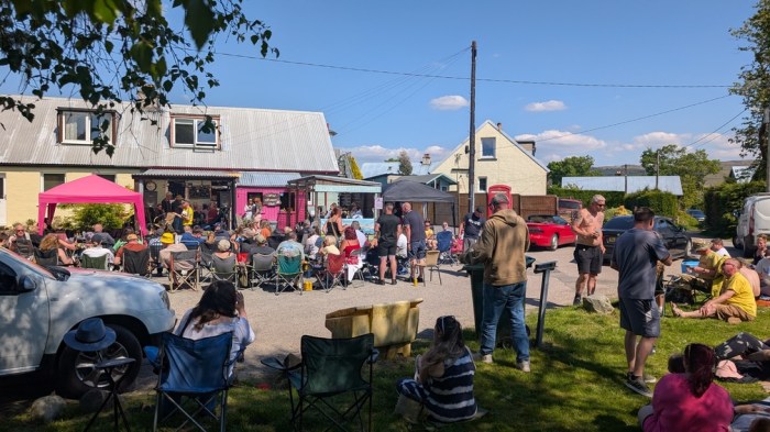
Some sort of mini-festival was taking place, with several live bands and loads of people sat around in camping chairs eating burgers and drinking in the sun. I just wanted an ice cream and a cold drink, so got those and retired to the shade of a nearby tree for a rest. None of what was there was bad, but it was so different to the expectation I’d built up of a nice quiet cafe, that it threw me. I filled up with water and headed on.
A little way along the road, I noticed that I was leaking water from somewhere, and stopped a couple of times to address it before I found it. This broke my rhythm somewhat, and made me keen for an early stop. So when I left the road to follow forestry tracks, I began keeping an eye out for potential camp spots. Looking at the map, the alternative was attempting to get to my planned night 2 spot, and thereby back on schedule. I wasn’t in a condition to do that.
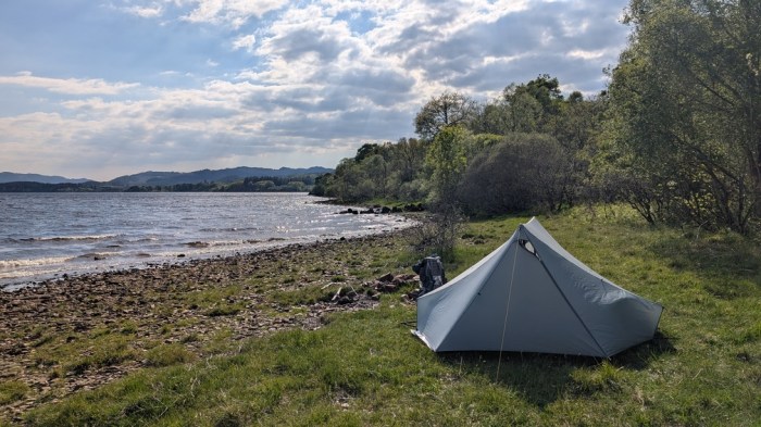
I soon found a spot on the shore of the loch and decided to go for it. It took a while to find a decent patch to put the tent on but eventually succeeded. The water from the nearby stream looked a bit iffy, so I decided to stick with the supplies carried from Dalavich – a degree of rationing would be needed.
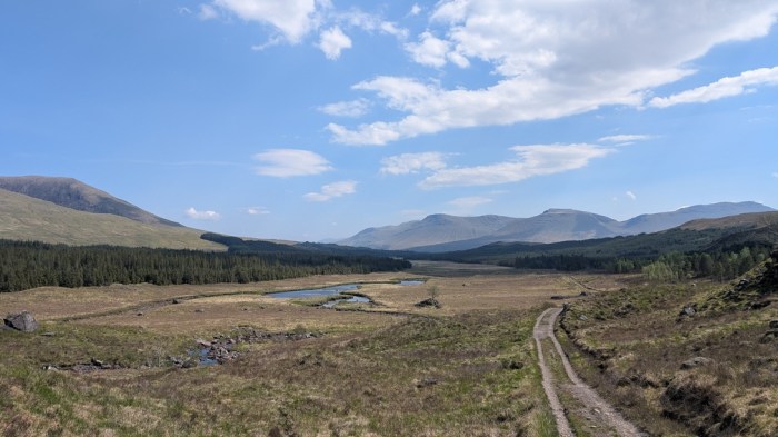
Day 3: Loch Awe to Glen Kinglass
38.0km and 760m of ascent. Total distance so far: 84.9km
I woke to a lot of midges waiting outside ready to pounce. Given I was still well behind plan, an early start (before 0800) was called for along with a big push. After two days close to roads and civilisation, I wanted tonight to have escaped all that, and so I decided to target Glen Kinglass, as originally planned, for camp. I wouldn’t make it quite as far as the spot on my route card, but simply getting to the glen would do.
The day broke down into 3 obvious chunks; 12km to Kilchrenan for coffee break, then 10km to Taynuilt for lunch and a top up of snacks from the shop, ending with at least 12km to the bottom of the glen.
I made good progress to Kilchrenan and then looked around for the cafe that I’d annotated my map with – no sign of it. Had I marked the pub as a cafe ? Either way, the pub didn’t seem to open until 1pm, and there was no way I was waiting around for that: I could practically be at Taynuilt for then.
And so that’s what happened. Another rollercoaster road with more traffic, a look at my original planned night 2 camp spot (not impressed), a rest at the entrance to a quarry, then the descent to Taynuilt, which took me about 1km off route (or in other words, which I hadn’t included in my distance estimates for the day). I headed for the cafe first, wanting something decent cooked, but it was very much a soup and toasted sandwiches sort of place. And the soup was mushroom, which I abhor. Tea and cake it was then. And a not cold enough milkshake.
The selection in the shop was wacky – there was nothing like cereal bars, or anything remotely lunch-like, but the asian cuisine section was impressive considering the overall sparseness of the shop’s contents. Or maybe that was all that was left. Suffice to say I bought a few disappointing bits, then headed to the post office to see what else I could get, only to find it shut at 1pm. Tactical error: it was open when I walked into Taynuilt. Doh!
The smokery was also shut.
My mood improved when I hit the forest tracks soon after the Smokery, and I stopped at a picnic bench to make the best lunch out of what I’d gleaned from Taynuilt. Back moving again and some actual scenery opened up. Even better, from a pacing point of view, the 3 glens that the track passed the bottom of were all spaced about 3-4km apart, which made for an easy feeling of making progress.
I turned into Glen Kinglass, following a pleasant path/track and a couple of kilometres later spotted a faint grassy track leading down to what looked like a level grassy area by the river. I went to investigate and decided to stop.
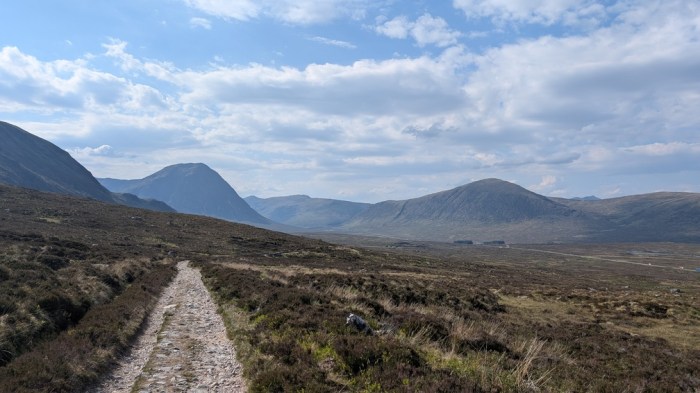
Day 4: Glen Kinglass to Glencoe Mountain Resort
34.2km and 744m of ascent. Total distance so far: 119.1km
Last night’s camp spot must have been one of the most insect-ridden spots I’ve ever camped in – ants, midges, ticks, spiders and loads of other creepy crawlies I couldn’t even begin to name. I even considered moving, but inertia won out and I then forgot about it.
I was away for 0730 as I had 32km or more to do, and wanted to get to the campsite as early as possible to maximise relaxation time.
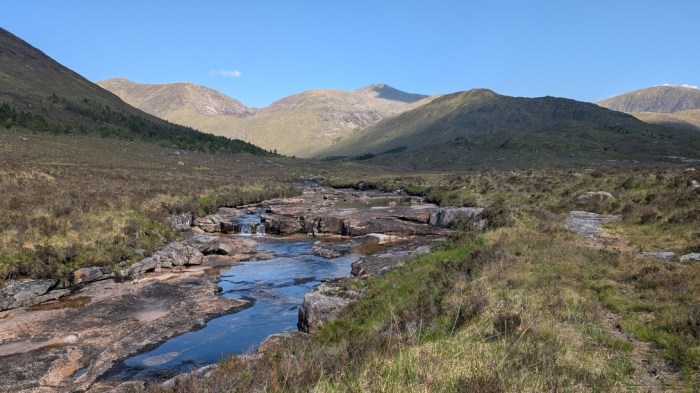
An easy track up the glen, and I concluded I’d picked the best camp spot scenically if not zoologically. I had a lot of distance to do, but extra time needed to be allowed to enjoy the scenery, now that I had some. A little way past the lodge, where there was lots of exposed rock on the river bed, I stopped for a brew up.

I made a bit of a mistake crossing the river, initially going past the bridge, then doubling back, then crossing it and enduring some rough and squelchy walking for a couple of klicks. I then came to where I’d originally planned to cross (before my vetter got hold of my route sheet), and saw that in the conditions we were having I could simply have stepped over the river, and moreover, had a good track/path all the way to it.
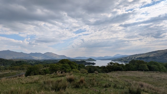
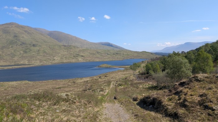
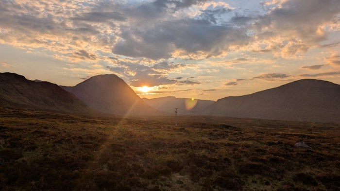
The climb up to the bealach felt hard – pretty much all the climbing I’d done so far had been on nice tree-shaded roads or tracks. And it was windy too. Eventually, I crested the watershed and looked down towards Loch Dochard.
A little way along, I found a nice tree to lean against and take a break.
The track crossed the river and I encountered a confusing sign that appeared to both encourage (from its direction) and discourage (from the implied tone) walking through Clashgour. I continued along a faint and winding path along the banks of the Abhainn Shira.
2km later I found the answer: the previous sign was very much a discouragement, as was clear from a matching, but correctly oriented sign at this end.
I took a short break when I reached the trees near the end of the track, and just before Forest Lodge. Now I just had about 10km along the West Highland Way to do.
This turned out to be the most tortuous walking of the day – a hard stony track under a blazing hot sun at the hottest part of the day. But at least there were people. Any scrap of shade was being used, resulting in a sort of West Highland Way game of leapfrog.
I took a rest about 1km before Ba Bridge and made it a proper boots off stop, which I really don’t do enough. This seemed to liven up the feet, and knowing that it wasn’t much further to go, I relatively flew along the trail compared with what I’d been doing before.
The final trudge to Glencoe Resort was really hard going – worse than I remembered – I could see my target but the stones underfoot were so jagged and uneven that it seemed to take forever to make progress.
Eventually I made it, went and checked in, and collected my parcel. Went for a shower and it was £1 for 5 very fast minutes. Moreover, the unit with the money/timer was outside the shower leading to time lost. I do wish campsites would simply put the price up and make the showers free. It was a crap shower too.
The food in the cafe/restaurant was ok though, and better for the fact that there was a bar with nice cold cider. I sat there on an actual seat, eating actual food, sipped my cider and called Control.
Good to see another TGO walk report from you mate! The first three days sounded like an incredibly disappointing cafe-crawl – missing, busy, shut, poor selection 😁
LikeLike
It’s weird though – at the time I noticed more the serendipity of things: the new campsite, the former Challenger stopping to chat, etc. But then that ran out and the disappointment set in. It’s my own fault though – I was 100% in control of the route I chose!
LikeLiked by 1 person
I guess that’s the difference between us – I’m definitely a ‘glass half empty’ kinda guy!
LikeLike