A trip with the express purpose of having my first wild camp. I chose an area I’d visited before, with reasonable options for a bail out if needed, but which also gave the opportunity to revisit places I’d not been for a while, some favourite places and to mop up some fells missing from my bag.
Travelling up to the Lakes and a walk up to Codale Tarn for my first ever wild camp.
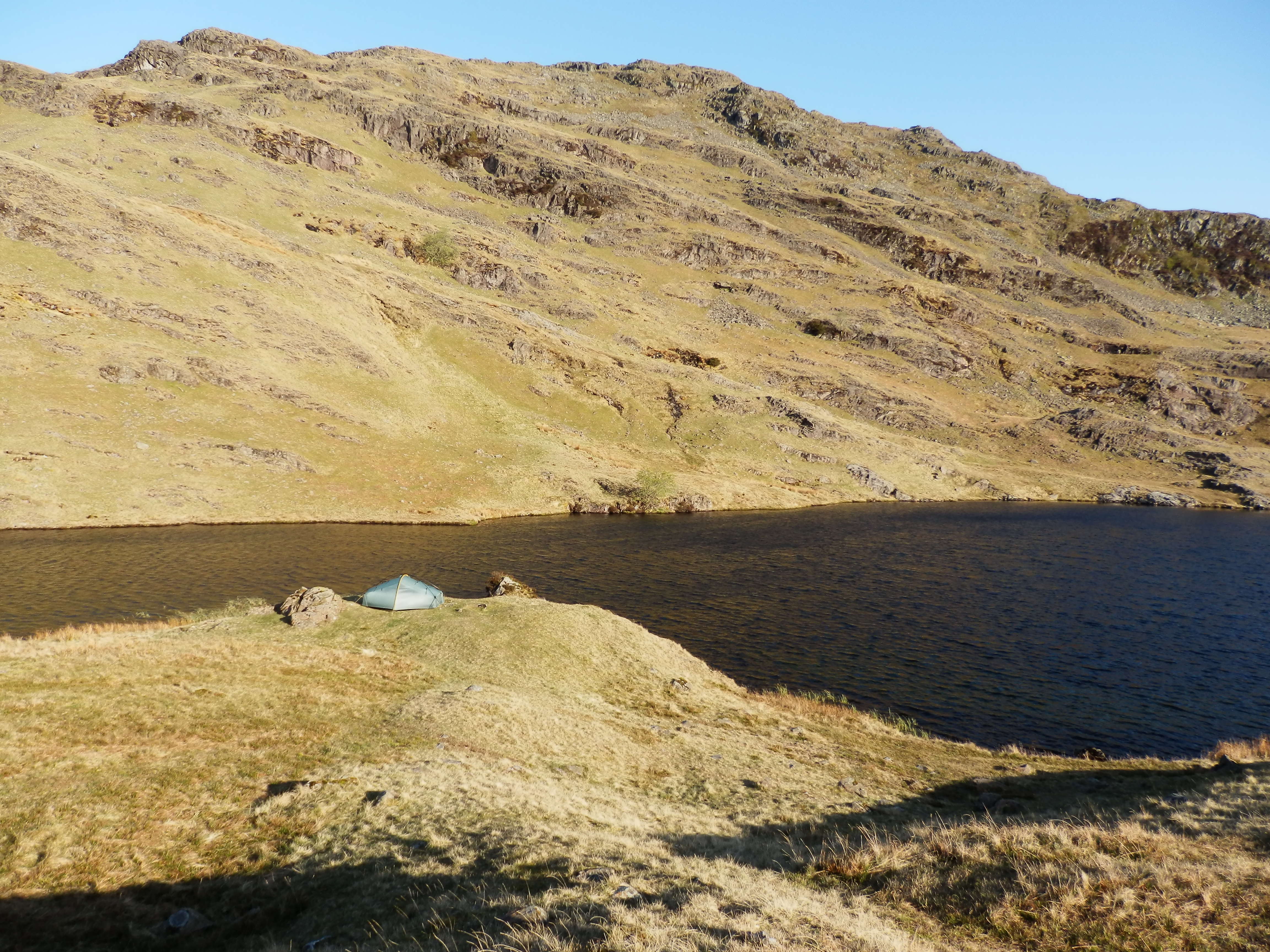
Morning at Codale Tarn
London was grey and damp as I passed through but as the train headed north it seemed to brighten, even revealing a patch of blue sky. I changed trains at Preston and settled down for the best part of the journey – the final scenic run into the mountains. As is my wont, I gazed left towards the Coniston fells and the Langdale Pikes, and right to the foothills of the Far Eastern fells, the excitement building from this exercise, as always.
Off the train at Windermere, and with the jaunty and confident moves of a seasoned local I was at the right bus stop in seconds.
A walk over the Langdale Pikes, a meal stop in Borrowdale and a camp on Rosthwaite Fell.
The pitch at Tarn at Leaves
All night the wind gusted around the tent, setting off metallic twangs as the crossing poles resonated. I lay shivering in my sleeping bag, barely dozing for much of the seemingly endless night, willing the dawn to come. …Continue reading->
A walk along the Glaramara ridge and descent to Langdale.
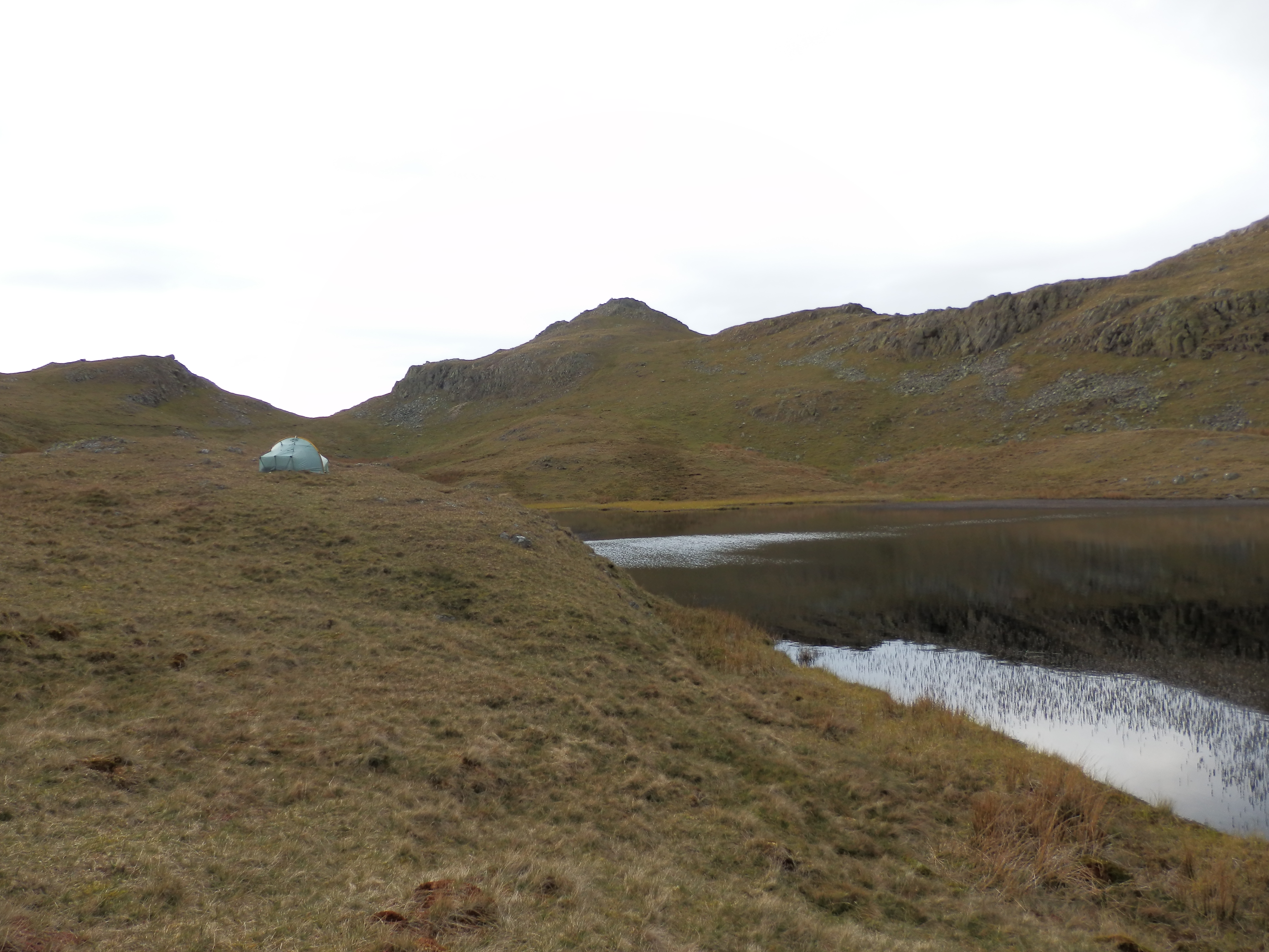
Looking to Dovenest Top
I woke (yes actually woke, thereby signifying that I’d actually slept!) early and stuck my head out the door to see if there was any sort of sunrise going on. Not much happening of interest, so I had a lie in. Sleep had come courtesy of no musical wind, a better set of nocturnal sartorial arrangements and I guess out of sheer tiredness.…Continue reading->
I lay in my sleeping bag enjoying the (relative) warmth having found that the recipe to not shiver all night was to wear almost every stitch of clothing and what I couldn’t wear to stuff down inside the sleeping bag anyway. Around me the campsite came tent by tent to life, the noises of fellow campers’ morning routines magnified through the canvas silnylon. …Continue reading->
The Route
Trip stats
Total Distance
24.82 miles (39.94 km)
Total Ascent
1,771m
Total Descent
1,782m
Total Walking Time
13 hours 55 mins
Average Speed
1.78 mph (2.87 kph)
Flat-Equivalent Distance
36.63 miles (58.94 km)
Flat-Equivalent Speed
2.63 mph (4.24 kph)
New Trail 100s
0
New Marilyns
0
New Hewitts
1
New Nuttalls
4
New Wainwrights
1
New Birketts
4
Hills Bagged
Date
Hill#
Name
T
Ma
Hew
Ne
W
WO
B
05/05/12
2407
Sergeant Man
–
–
–
–
R
–
R
05/05/12
2396
High Raise
R
R
R
R
R
–
R
05/05/12
2413
Thunacar Knott
–
–
–
R
R
–
R
05/05/12
2417
Pike of Stickle
R
–
R
R
R
–
R
06/05/12
2467
Rosthwaite Fell (Bessyboot)
–
–
–
–
159
–
252
06/05/12
2453
Rosthwaite Cam
–
–
–
147
–
–
253
06/05/12
2447
Dovenest Top
–
–
139
148
–
–
254
06/05/12
2431
Combe Door Top
–
–
–
149
–
–
–
06/05/12
2408
Combe Head
–
–
–
150
–
–
255
06/05/12
2389
Glaramara
R
–
R
R
R
–
R
06/05/12
2388
Allen Crags
–
–
R
R
R
–
R
“R” denotes a repeat visit to a fell already bagged. A number indicates how many of that type of hill have been bagged.
I use Anquet digital mapping to plan my routes. The picture in the blog is simply a screen capture (ALT+Print Screen in Windows) that’s then pasted into Powerpoint as a picture. I then crop it and add in other pictures/shapes etc to annotate the map. Then select the whole thing and save as a picture from Powerpoint. I do this in Powerpoint because it’s easiest to save the end picture from there. The process would clearly also work if you scanned or photographed a paper map marked up with your route.Hope that helps.


Great blog- how did you manage to get your route logged to a map and pasted to your blog,
I would be most interested to find out the process thanks
LikeLike
I use Anquet digital mapping to plan my routes. The picture in the blog is simply a screen capture (ALT+Print Screen in Windows) that’s then pasted into Powerpoint as a picture. I then crop it and add in other pictures/shapes etc to annotate the map. Then select the whole thing and save as a picture from Powerpoint. I do this in Powerpoint because it’s easiest to save the end picture from there. The process would clearly also work if you scanned or photographed a paper map marked up with your route.Hope that helps.
LikeLike