Day 1 – Friday 6 June
A few squirts of air into the Airbeam frame of my new Gossamer Gear Mariposa Pack and then I swung it up onto my shoulder and left the house for the short walk to the station. It’s usually on the walk to the station that I begin to suspect I’ve overpacked and that a crippling weight after only 100 yards of pavement walking doesn’t bode too well for lugging it all up a hill. But not this time – it actually felt ok, leading me to suspect I’d omitted something critical. But that couldn’t be as I have an OCD level of gear checklist specifically to ensure nothing is forgotten. Maybe I’d just packed sensibly and maybe the pack was working some of its own magic in terms of the carry. More about the wonders of this pack in a future post.
The journey to Windermere was uneventful, and I arrived there with some time to kill before the bus to Coniston. This just about gave time to choke down sausage and chips and get essential supplies (ie beer) in Booths. The bus dropped me in Coniston and I then spent a while on the start of walk faff – most of which was trying to get the Spot to work, the main issue being that I’d not paired it with my new phone, the app had been upgraded too and there was next to no mobile phone signal to synchronise with my account. Eventually I gave up and used Viewranger, which I usually avoid on a multi-day walk because it runs my phone battery down a lot.
I set off up the lane next to and behind the sun Hotel and onto open countryside, climbing steadily up alongside the beck. A warm day and soon the evidence was trickling down my face. The first half day’s walk on a trip like this I usually find to be hard going as my body gets used to carrying the weight of my pack and to actually walking on rough sloping ground – something there isn’t much of around London. So plenty of stops were taken to look at the views before I reached the old mine workings.
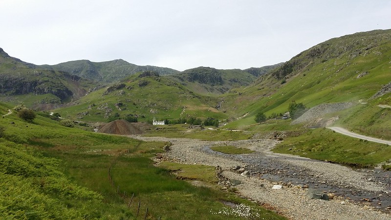
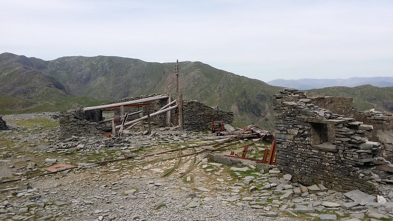
I poked about for a while looking at the remnants of that long-discontinued industry, and then resumed the climb shortly reaching Low Water. The last time I was here was in June 2007, and I didn’t linger on my way day from the Old Man due to trying to catch the last bus. But today, although I had a fair chunk of distance I wanted to get done, I wasn’t under quite the same sort of pressure, so I took a bit more time to take in the surroundings. I also headed off to where the outflow is and clambered down a bit to get some nice fast running water to refill my bottle.

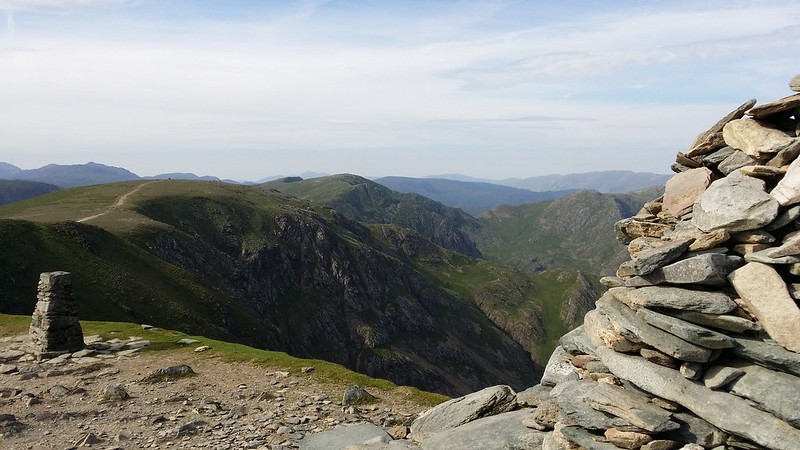
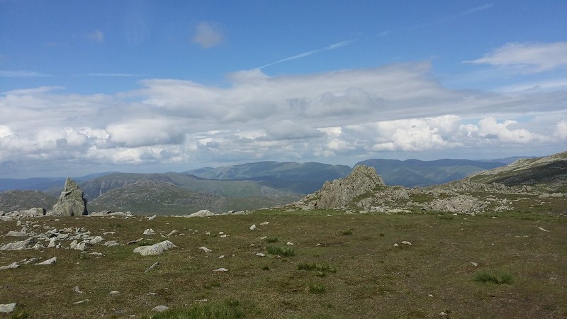
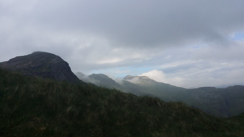
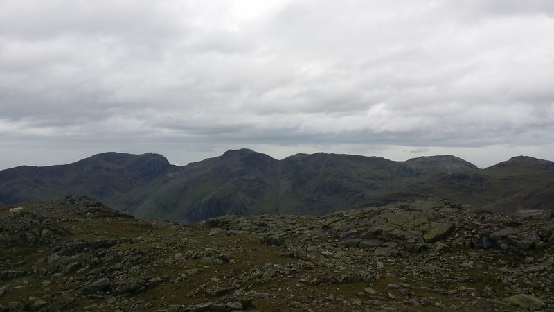
Now came the steep pull up onto the ridge that leads to the summit, the views getting better almost with every step. The Scafells stood out in sharp relief against the light sky, in contrast to the blur of Black Combe in the far distance. Skiddaw, Blencathra and Helvellyn were also in sight to the north and east. I took in as much of the view as I could commensurate with getting on with the walk and then got going again.
It didn’t take much work to get me onto Brim Fell.
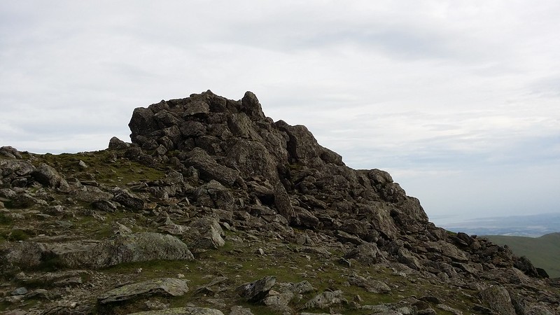
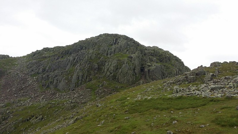
With Dow Crag in my sights, I looked for the path marked on the map down to Goat’s Hause, and not finding it just struck directly down the slope. Below me 3 people I’d seen catching me rapidly on the climb up to the Old Man had overtaken me, and having seen earlier how much they were carrying, could tell they were heading for a wild camp somewhere. I just hoped they’d not had the same idea as me – but took some comfort from the fact that they were German (I think) and probably didn’t know the area so well, so the chances of them heading for the same spot should be quite small. I climbed up from the col onto Dow Crag and did the final clamber over the rocks to the summit.
The wind was now really getting up and although it wasn’t threatening my footing, it was such that I didn’t want to camp in the full force of it. With this in mind, I upped my pace to give myself that bit more time to find appropriate shelter later on. I walked on over Buck Pike to Brown Pike, the point at which my very first backpack fell apart 7 years ago. [On that day, I’d struggled under a wildly optimistic weight up from Coniston to Brown Pike, taking all morning to get there, and all but unable to get going again after lunch. That day’s plan to walk over to Langdale to camp was shot to pieces from that moment and the trip never recovered.]
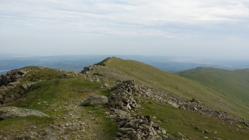
A lot has changed in those seven years, and today I was moving confidently across terrain I knew a lot better, carrying a sensible load and using skills and judgement I never expected I’d acquire. The key question taxing my mind as I headed south along the ridge was tonight’s camp location. I was concerned that the planned spot on White Maiden might be too exposed for a comfortable night and I looked down at Blind Tarn as a possible alternative. I’ve wanted to camp there for a while, but from above it was difficult to see whether there was much in the way of shelter from the wind which was blowing straight from the east – i.e. straight into the tarn. I made my mind up and carried on.

I spent a few moments reminiscing at Brown Pike and then continued down to the Walna Scar pass and straight up onto Walna Scar itself. An unimpressive summit, marked by a few stones to form a half-hearted cairn, it wasn’t worth a long pause, and I continued along the ridge, the path taking me below White Maiden towards White Pike. Although I hadn’t intended going all the way out to the end of the ridge, I was doing ok for time, so went with it. I spent a while looking for a suitable pitch on White Pike, and not finding any I was happy with, headed back to White Maiden, slanting off to the right to follow the wall as soon as I could do so without major descent. The wall was my best hope of shelter, but as is often the case, any flat ground in the shelter was also boggy. Before I knew it I was at the summit.
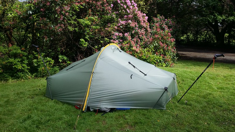
I spotted a potential spot just below the summit that seemed to be sheltered by a rocky outcrop and the end of the wall, and clambered down to it, finding it flat enough, not wet and mitigating the worst of the wind. I threw up the tent and moved onto the next issue: water. You see, there is virtually none on these fells apart from what’s lying stagnant in the tarns. I’d seen no sign of run-off from the path along the side of the ridge, despite the map suggesting there might be some. I resigned myself to drinking from the tarn, and thereby putting my Sawyer filter to a real test.
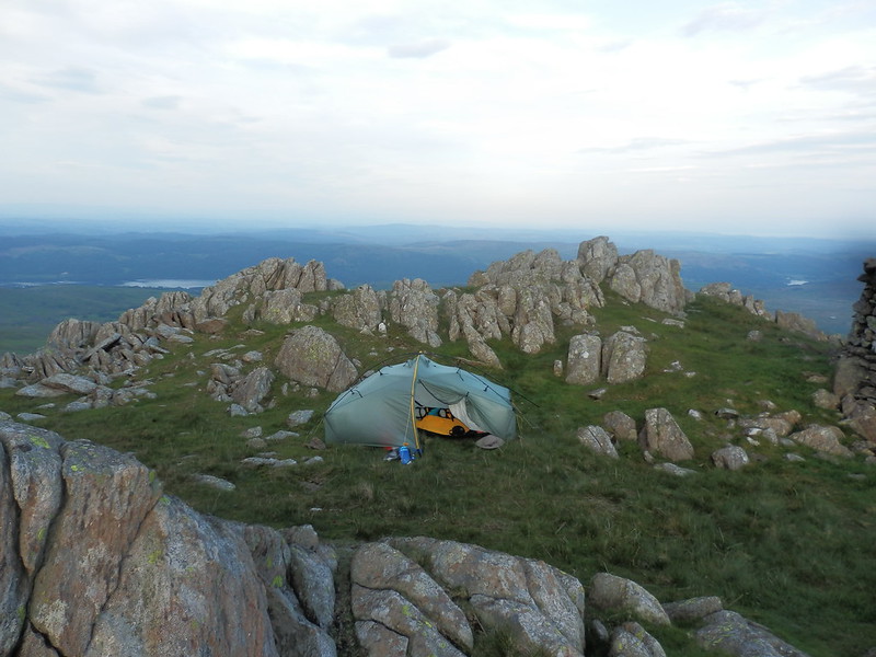
The water looked liked it had already been drunk once (if you catch my drift) even after filtering, but was still a lot better than the neat tarn juice. Indeed I was surprised how much colour the Sawyer had taken out of it – filters don’t usually have much impact on the colour of the water, just on what’s floating in it. But with the filter running slowly, I think I had my answer – clearly quite a lot of gunge had been kept out by the filter. A mental note was made to give it a good backwashing when I got home.

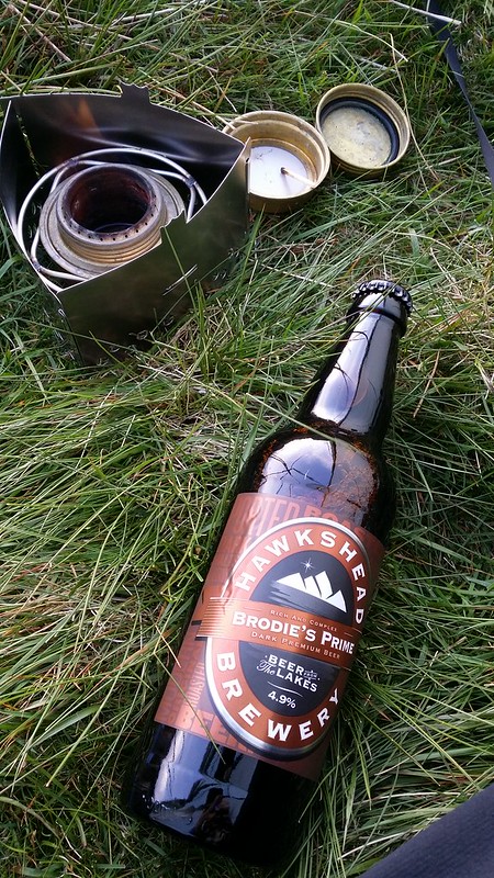
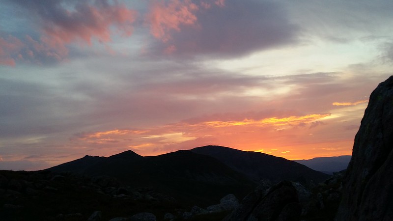
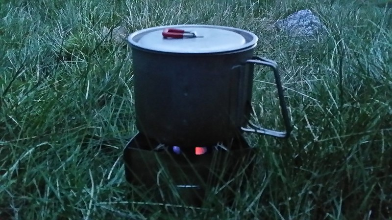
Dinner went on and the beer that I’d carefully carried all the way from Windermere was opened and consumed slowly, enjoying the chocolatey aroma emanating from the bottle. It turned out to be a fortunate choice – selected by the highly scientific method of choosing the local ale that was strongest and darkest. I popped up onto the summit a couple of times to watch sunset developing, and then retired for the night.

Day 2 – Saturday 7 June
Lying in the tent, I could hear the strength of the wind passing overhead, but broken by the ramparts of my rocky castle, and Monica was barely moving as a result. The windy noises were enough to prevent an unbroken sleep, however, although it would have been a lot worse if the tent had been in it directly. With some relief, the light infiltrated and realising that I wasn’t going to get much quality sleep thereafter, I stuck my head out of the door to see if there was anything to look at. There was…
I stuck my head out periodically as the colours in the sky developed, whilst I packed up and had breakfast. I was off walking at 6am on the dot. Today’s target was straightforward – get off the hill before the manky weather forecast for the day came in, and also to meet Cath (@wellycath) who was joining for the rest of the trip. But with such an early start, I had plenty of time to play with.
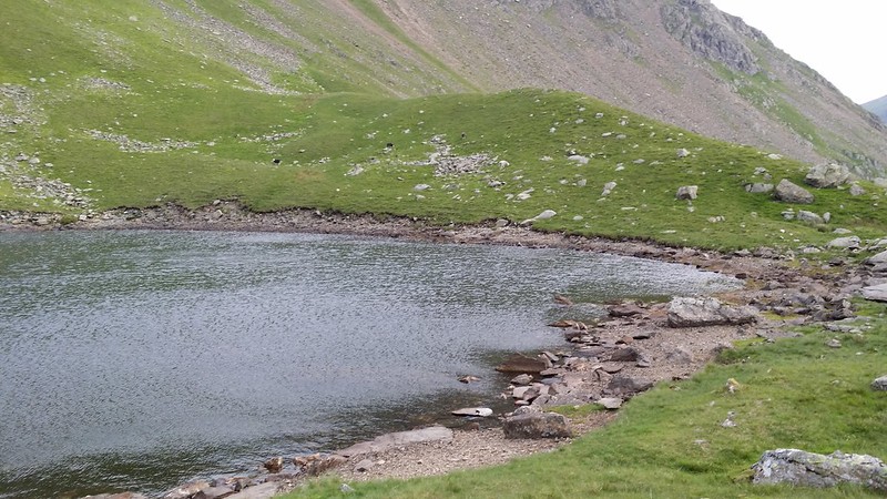
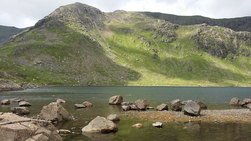
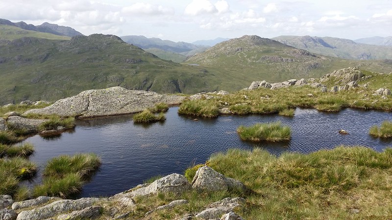
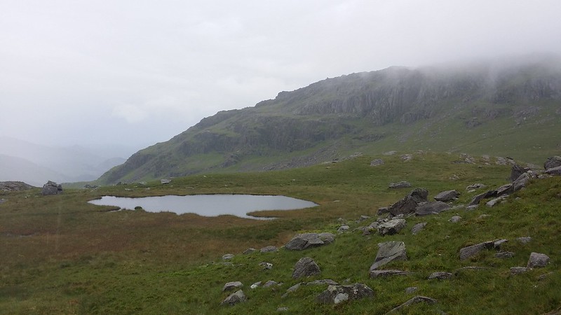
I skirted the top of Walna Scar (interestingly Social Hiking recorded the bag now rather than when I actually went over the top the previous day – maintaining the 100% record of incorrectly recording this top) and joined the Walna Scar Road, heading down and looking out for the small track to Blind Tarn. I found what I thought was the track, which took me through the old mine workings and left me picking my way precariously through rocky detritus until I stood looking down on the tarn. A few moments of care saw me down at the tarn itself and I took my time to explore what could have been last night’s camp, and proclaiming it “campable”.
I saw a track through the grass cutting down towards the Walna Scar Road and followed it, coming out at a point I’d stood last year in the snow and wondered if that were the way up to the tarn. Well, now I had my answer, and mental notes were made for next time. I continued down the path, taking some time out by one of the streams that flows down to form Torver Beck, to refill with potable water, and discarding the more disturbing beverage from the previous night. Further on I decided to definitively find Boo Tarn, having failed to identify it on any previous passage. It wasn’t too difficult, although you could easily be forgiven for missing it.

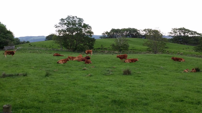
I reached the car park and carried on down the steepening road that leads down into Coniston. On my right a field of cows lazed about, and I did a quick headcount of standing v sitting, coming out with 80% lying down and adopting that as the official likelihood of rainfall.
It was nearly 8:30 as I strolled through the largely deserted streets of Coniston, with the only sign of life being a handful of early morning runners and dog walkers. My objective now was simple – 2nd breakfast, and after checking out the places on the way, ended up at the one opposite the bus stop.
The rain started just as the bus arrived, and of course there was someone in front of me who was having a long negotiation with the bus driver over the best ticket to get (all of which could have been avoided if she’d simply taken up the free bus pass she was clearly entitled to!), so I got steadily wetter whilst waiting to board the bus.
I spent a few hours in Ambleside, doing an inspection of the gear shops, leaving empty-handed apart from some Fuel4. A pint in the White Lion and then I decided to head down to Windermere to meet Cath’s train. 2:30 saw us both back in Coniston and devouring afternoon tea while we waited for the hostel to open. Having seen the forecast, we’d taken the precaution of booking in there, and as it was already full, had booked camping. At £9 (member’s rate) it wasn’t too bad when you consider the YHA facilities at our disposal too. A YHA dinner and pint in the Black Bull got us to bed time.
Day 3 – Sunday 8 June
Somehow my body knew I wasn’t wild camping and that there was no sunrise to be seen, so I slept through. I was still up before anyone else it seemed, and darted into the hostel to make a cup of tea. A leisurely breakfast and then a slow pack-up while we talked to fellow campers, made for a late start. We walked into Coniston and looked at what the day had in store for us – as it turned out, the weather had largely cleared soon after we got to the hostel, and this morning there were a few exchanges along the lines of “we could have wild camped”, but what was done was done. We headed back for the Coppermines valley, this time sticking to the right side of the beck and heading for Levers Water.

We passed the hostel, glad we hadn’t stayed there (full of schoolkids), and gradually made our way up to the tarn. A wall across our path signified our arrival. We stood for a few minutes admiring the green-tinged waters and the view back down to Coniston.
The first terrain grumbles came from Cath as the path became more of a rock-hop alongside the tarn, none of which was helped by me telling Cath what the Prison Band was like. By the time we arrived at Swirl Hawse, she’d built it up in her mind to the point where ropes may be required, not helped by me describing the conditions in the snow last year – this had been meant to reassure her (in that if I could do it in winter conditions, then it would be fine now), but hadn’t worked.
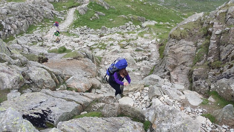
To put off the horror for a while, we took lunch overlooking the top of the Greenburn valley with Pike o’Blisco in front of us. Then we set about the climb up to Swirl How. Not really steep and exposed, the Prison Band does, however, offer a few points where hands are needed to negotiate rocks, and Cath was struggling with her shorter legs to follow my route, and a few diversions were called for on her part.
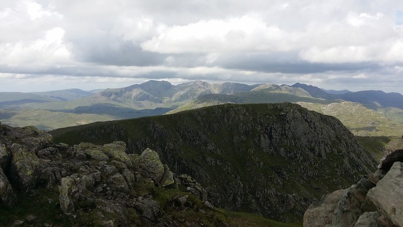
We reached the top and a stiff breeze and looked for some suitable rocks to break the worst of the wind and a short break and view stop. And there was quite a lot to look at, and acquaint Cath with. In the distance Skiddaw, Blencathra and Helvellyn could be seen, the coast behind us, but the eye was mainly drawn to the Scafells and head of Eskdale in the middle distance.
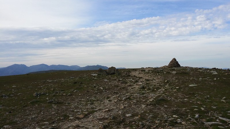
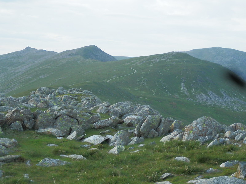
Next stop was Grey Friar, intended camp spot on last winter’s trip, but not reached on that occasion. Having seen the photos and videos from others who’ve camped there recently, I was keen to revisit a fell that I last saw in 2007. We took our time exploring the summit plateau and finding several places to camp. Half tempted by calling it a day there and then and pitching up to enjoy the views, common sense prevailed as we still had many hours of daylight left and a camp here would bugger up the walk plan. It’s definitely gone on the wishlist though.
We headed back up onto Great Carrs and spent a few moments at the Halifax bomber wreckage just below the summit – somehow I’d not seen it before, despite passing this way a few times.


We took another 5 minute break in the lee of rocks on Little Carrs and then got going again, finding another spot that took our fancy off to the left of the path on our way down Hell Gill Pike. This was also very tempting.
We persevered down to the Three Shire Stone, and seeing the path underfoot I was surprised I’d made it in one piece in the snow last year.

Now the climb up to Red Tarn, and as we gained height my legs felt great, good enough for a few more miles, but Cath’s were feeling the effects of this bring her first day walking compared to the third for me. So we reached the tarn and scoped out somewhere to camp.
Not finding a patch of suitably flat and dry ground to our liking, we followed the path towards Langdale for a while and then investigated Browney Gill, my camp spot of last winter. Not expecting to find a big enough dry patch for two tents, I was surprised to find exactly that, although it took some proof for Cath to be happy.
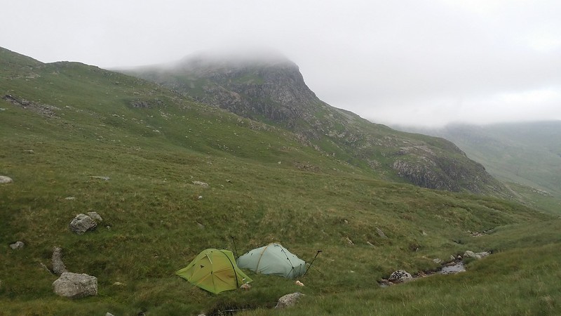
We made camp and settled in for the evening. I got my Chicken Korma going while Cath played with her stove. Hearing a roar behind me, and expecting to be taunted by Cath’s much faster brew, the roar suddenly stopped and a burst of swearing floated over from Cath’s direction. The world’s lightest gas stove had stopped working. No amount of fiddling or abuse would get it going again, and she became dependent on my charity.
Whilst not fast in comparison with a gas stove, the Trangia triangle, Fuel4 and Titan Kettle combination got there eventually, although multiple boilings were required to satisfy cravings for food, tea and hot chocolate. As we sat there, cloud seeped in over the head of Langdale and looked as it was there for a while. We dropped off to sleep, lulled by the sploshing and tumbling of the gill alongside the tents.
Day 4 – Monday 9 June
The fine conditions of yesterday were gone, and the remaining patch of blue over where the western fells would be was soon swallowed by cloud. Just as we set off, the rain started, lightly at first and gathering pace the higher we got.
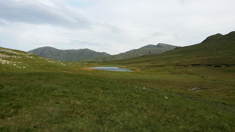
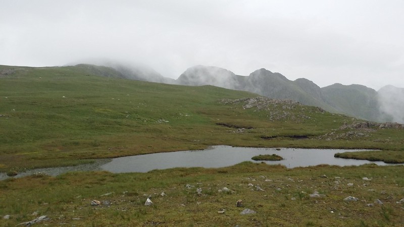
We followed the path up to the col between Cold Pike and Great Knott and struck left for the top of Cold Pike, finding it in mist. Out came the compass to strike west for the West Top and ultimately the Far West Top. In the mist, determining the actual tops from mere foreshortened minor outcrops became a bit of a game, but steady persistent progress got us there. Soon the cloud cleared and ahead of us was the Far West Top, my personal favourite of this triple Nuttall fell. Below and to the left lay the tarn that had been my original idea for the Sunday night’s camp. We walked down to the tarn itself, finding it boggy and the best chance of such a camp being right on the edge overlooking Gaitscale Gill. Seeing a bit of a steep clamber up to the actual summit, Cath opted to meet me on the other side, while I scaled it.
Now we headed towards Great Knott, across the boggy depression, passing by the second, larger tarn and then making our way to join the main path to the Crinkles. I then detoured to take in the top of Great Knott itself, while Cath had a faff about and then met me further up the path. I couldn’t resist the short diversion to Great Knott Tarn on the way back to the main path, especially as the cloud lifted at that point, etching the Crinkles against the sky.
As we gained height towards the first Crinkle, the intensity of the rain increased and by the time we reached the first big outcrop, visibility was gone and the wind had picked up. A debate held while I was halfway up the outcrop as to the merits of continuing over the rocks or bypassing totally resulted in an attempt to skirt the worst of the wet slippery rocks. After a bit of hard going over the sloping rock-infested mossy foot trap and an attempt to regain the main path we spied the 2nd Crinkle ahead, and I pointed out the Bad Step.
There was no question of an ascent via the Bad Step, so we took the chicken’s route around and up the loose rocky path, before cutting back over the top of the Crinkle to the summit. Now in following the path down and taking the easier of the apparent options, we found ourselves a little further west than ideal and consequently had a bit more work to contour around to the base of the next Crinkle.
This route having been less than ideal, I announced that we would be better sticking to the actual path and accepting a bit of rock work rather than keep trying to skirt the outcrops, and that’s what we did. A couple of clambers that I thought Cath would baulk at, she handled with no complaint, and we made decent progress through the murk over the rest of the Crinkles and Shelter Crags. A man out for his morning run with his dog passed us by, causing both to wonder why someone would choose the Crinkles for such a morning constitutional in these conditions when surely there were better choices.
We arrived at Three Tarns, but it was too murky to really enjoy it. Both us seemed to feel that further progress wasn’t likely, and my mooted plan of a pint in the ODG and a campsite or YHA for the night was met with acceptance, so we headed down The Band to the security and bright lights of Langdale.
A pint later and we looked back up the valley to see it clearing, but the die was cast so we hopped on the bus to Ambleside, where we found the hostel full. A bus ride towards Windermere and a sharp pull up the Troutbeck road saw us safely ensconced in the Windermere hostel.
Having made a dinner plan based on staying in Ambleside, we headed back down to the main road for bus (missed) and ultimately taxi into Ambleside for the traditional end of trip curry and a pint in the Lily (which seems to have lost its gilding since we were last there in January).
The Route

Cath’s write-up of the trip: Clag, Crags and Self-doubt – An early June wander in the Southern Fells