With the 10-in-10 approaching fast, some training was called for if I was to maintain any of the hill fitness from my Southern Fells trip for long enough to have a hope of getting me through the challenge itself. Where I live is really flat and some of it is even below sea level, (well according to my altimeter at least), so much in the way of ascent is out of the question, along with rocky terrain. But what I could do was distance, and use extra distance to compensate for the lack of steep hard ground. So that’s what I did…
First Attempt: Hayfever and Deathtraps
I got back from the Lakes on Tuesday, and with a busy couple of days following, it was a not particularly auspicious Friday 13th before I got the chance to fit a decent walk in. I’d originally thought about a walk on the North Downs in preference to an Essex walk, as the other side of the river usually provides superior terrain – it’s hillier and the paths are usually in much better condition. But I just didn’t get around to it, and the “get up and go” required to get over there early to do a big route and arrive home at a sensible time just wasn’t present, so a local walk it was. I settled on a walk along a section of fen I’ve done several times before, with the intention of extending it as needed and then simply making it up as I went along. At the back of my mind was the fact that Thurrock’s “top”, although bagged by me some time ago, hadn’t been done with Social Hiking and it was starting to look embarrassing that my local “peak” was showing as unbagged on my maps.
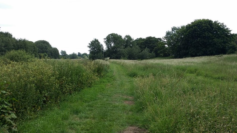
The morning was well advanced by the time I got going and I set off from Chafford Hundred station along the B186 heading for the Mardyke Valley. It was good after a mile or so of walking to step off the road, duck down behind the trees and emerge into a more rural landscape.The first thing that struck me was the green – everything around me was one of a variety of shades of green, and much of it was overgrown. Various dried grasses and nettles signified the likelihood of some challenges to my nose and my shorts-wearing legs respectively.
The walk along the Mardyke went pretty much according to plan – the path is usually clear and good progress can be made. I arrived at the top of the Bulphan Fen and considered my next move. Last time I was here, the path I wanted had been closed off, but seemed to be restored now. Even so, I’ve become wary of unknown paths around here – they seem to get so little use that they get easily overgrown, and consequently they’re easy to lose. There also seems to be a disturbingly high incidence of paths being blocked by barbed wire or electric fences with no crossing, despite clearly marked rights of way.
So this time I chose to follow the farm lane past Judd’s Farm and pick up a path further down – I could easily drop onto a lane if need be. The first sign that this perfectly reasonable plan wasn’t going to work was the path along the field edge when the lane ran out at Judd’s Farm. What appeared to be the path ran through waist high nettles on quite uneven ground, and after a few minutes gamely trying to stick to where the path should be, I gave up and walked in the open field, despite the watching attentions of a nearby farmer.
Once out of that field, though things improved slightly, and I crossed several fields on Stringcock Fen (the names around here would give the Carry On films a good run for their money), without incident, other than the challenge of relating what I saw on the ground to a pretty empty map.
Through the bushes I could see, and hear, glimpses of the road that I needed to reach, and here my luck ran out with no apparent exit from the field. Backtracking didn’t help much, with the best option being a deep ditch of indeterminate bottom covered in nettles and nothing to hold onto. I carried along the field edge with the road feet away but unreachable. A hundred yards or so along, I found a crossing in the form of a shallower less overgrown ditch, and I forced my way through the small gap, emerging onto the road with relief.

Legs now suffering from nettle stings and the attentions of pollen-laden plants, it was a small relief to walk along a road that I could rely on to take me where I wanted to go. But it couldn’t last and three hundred metres on I arrived at Kings Farm. I skirted the farm buildings and stood at the corner of the airfield trying to work out where the path is, eventually finding evidence of it the other side of some bushes. Having found it, I made decent progress along the side of the field, until the point it should have turned to head directly for the road. No sign at all of the way. Plenty of impenetrable bushes and barbed wire though. A couple of hundred metres away I could see the Dog and Partridge, but no way to get to it.
Never mind, I’ll follow the field edge until I can find an exit, I thought. Nearly a kilometre further on and I’d had no luck and was approaching a road, which should be ok, albeit a bit further out of my way than I wanted. The deep bramble-laden ditch with invisible bottom and questionable footing scuppered this though and I found myself right at the edge of the farm garden. Now faced with a choice of simply walking across their garden or risking the ditch, I didn’t know at first what to do. I lurked in the trees at the edge of the field, and pressure in the form of the farmer’s wife came through the field mowing grass. Now if spotted, brazening it out would be a lot harder whatever I did, although to be honest I was angry enough to not care either way – at that point I’d happily have walked through their dining room while they were eating dinner. She disappeared into the farm itself and I decided to risk the ditch as easier to explain. I took it carefully, and managed to keep my footing.
A few seconds later and I was hauling myself up and onto the road, but I’d taken some damage. Stings and cuts covered my legs, and my hayfever was now out of control. Time to admit defeat. I walked along the road to the junction with the A128 and called for a lift.
The route

Second Attempt: Southend or Bust
A camp at the weekend, seemed to have restored morale, and Tuesday was the day anointed for the next training walk. With the challenge itself on the coming Saturday, common sense suggested this was the last opportunity to do a big walk and still have recovery time for optimum freshness on the day. So an idea that had been lurking at the back of my mind was brought out to air. Since distance was the only way to compensate for the ascent and hard terrain, then I’d walk to Southend, a mere 25 miles away.
This felt like a viable plan as I’d walked much of it already in last year’s walks along the river, but it was only when I measured the distances found this would involve nearer 30 miles and having never walked more than about 22 miles on a single day’s walk (and that was 25 years ago!), felt this to be grossly unrealistic. So I went back to Anquet and plotted a more direct route. Given recent experiences with countryside paths locally, I was happy for a big portion of the walk to be on tarmac – indeed the hard surface should help toughen things up for the weekend.
I made my “official” target to get to Leigh-on-Sea which would be around 20 miles and could still be considered to be part of Southend, but knew I really wanted to get all the way to Southend proper as only that way could I do enough distance to compensate for the rigours of the 10-in-10. I even had an extension option of carrying on to Shoeburyness if the situation arose (it didn’t).
I set off early and as everyone else set off for work, I was leaving the urban sprawl and walking down a country lane towards Orsett.
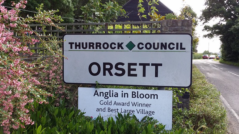
I passed the mill at Orsett, and wandered into the village itself.

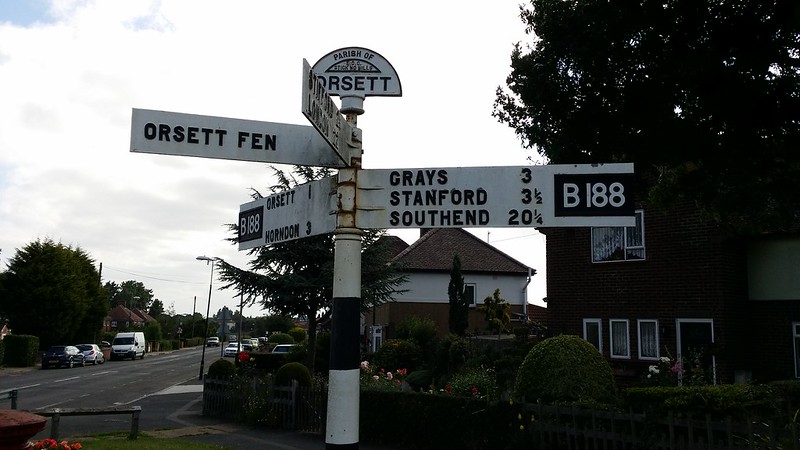
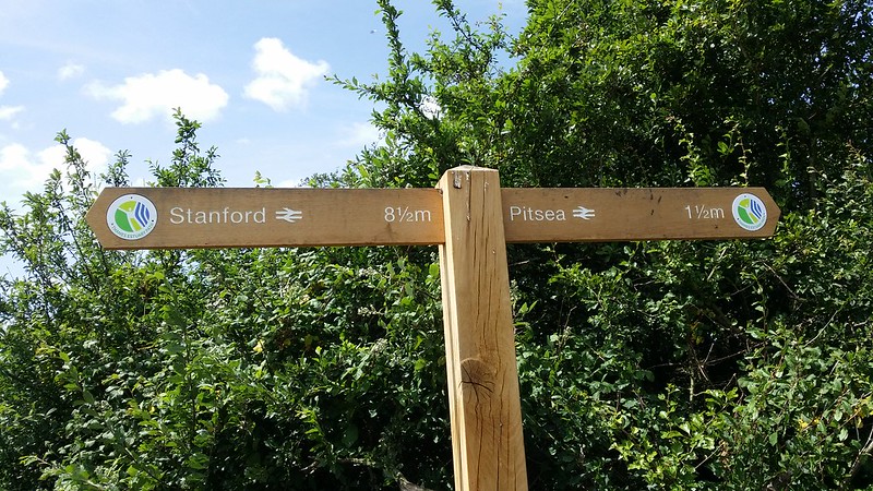
After 5 miles of walking, it was concerning to see this sign, which showed just how far I still had left to go.
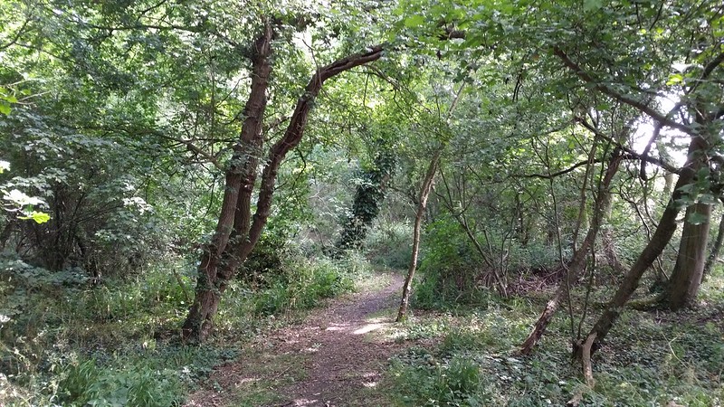
After my escapades from the previous Friday, I was very wary of taking too many rarely used paths, but on a footpath out of Orsett a walk along the edge of a ploughed field suddenly became this…
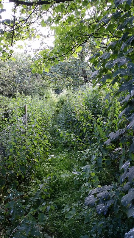
Although just a matter of taking it steadily, avoiding the electric fence that appeared on my left, and helped by not having legs exposed to the horrors of summer walking, it’s still not the path I would have chosen. I put the picture up on Twitter and this seemed to kick a number of local people into a discussion about the state of Thurrock’s footpaths, which got a bit political. It was quite telling that most of the paths they were moaning about were inside the urban area, not the proper countryside ones.
I stepped carefully out onto the A128, ducking under some prickly branches and twisting around the last of the brambles, and already I was up on Friday’s efforts. A walk along lanes brought me to Horndon-on-the-Hill.
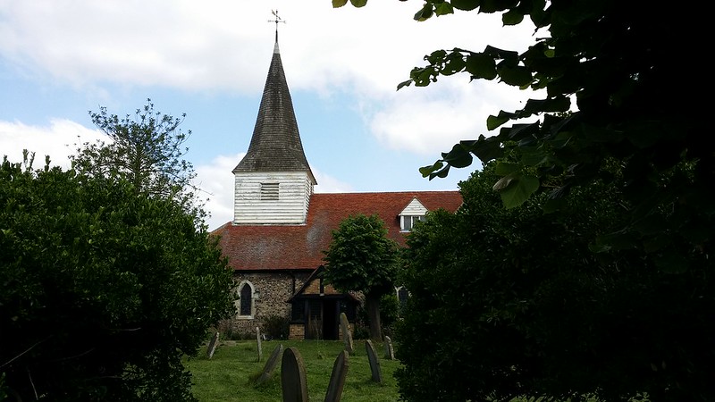
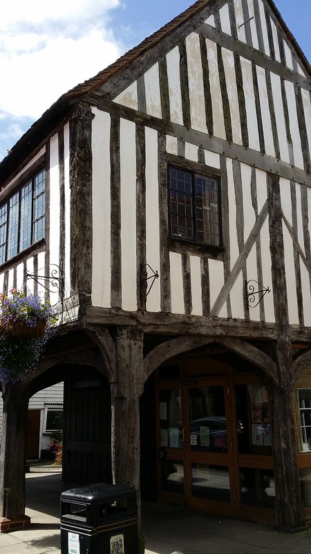
It all looked rather quaint, and as I’d never actually been through here, I ambled on at not much speed. Then I found myself on paths across fields, and better still ones that get used, as I was following the route of something called Stan’s Walk, which turned out to be a walk named in honour of Stan Dyball of Thurrock Ramblers. The renovations of the stiles and path still seemed to be going strong. I wish Stan had lived a tad further west though!
The path flirted with a farm lane and the field edge and I was pretty fickle about which I used at any point, simply using whichever looked easiest. Shortly the lane/field ran out and a thin sliver of woodland gave some shade on what was already a really warm day.
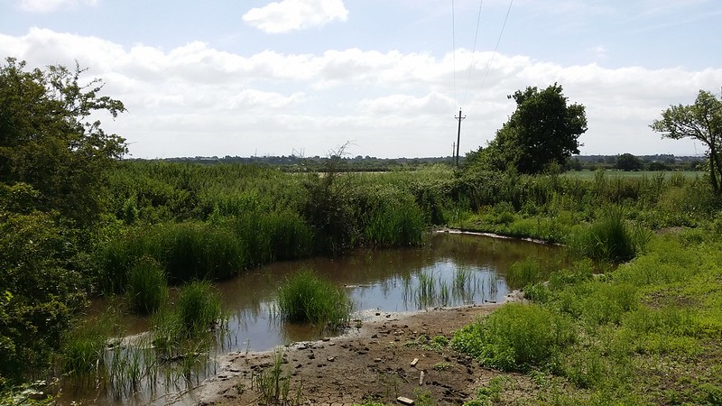
I emerged from the wood to the distant hum of the A13 and knew it would soon be time to cross it. I briefly considered a detour left to bag Thurrock Mountain (Langdon Hills), which I’d failed to pick off on Friday, but with a long walk still to do, thought this would be tempting fate and risking non-completion. The Mountain would have ot wait for another day. The path brought me alongside a pond and as is my policy with mountain tarns, I spent a few minutes taking in the scene, the view marred somewhat by the giant cranes at the port in the distance.
I crossed the A13 and did a stretch of road walking as far as Vange, then headed back to cross the A13 and a few yards further on, the railway.
Not technically a public right of way, but a short stretch of farm lane would bring me to it, and avoid me walking nearly all the way to Pitsea on urban tarmac. I got on with it, trying not to attract too much attention and joined the footpath proper to walk across Vange Marshes. Much of this has improved since I was last here, and plenty of new signage with Thames Estuary Path waymarks.
A brief lunch stop and catch-up on the raging debate about a footpath next to a school, and I caontinued. I arrived at Pitsea station and was now on that part 0f the route that tracked the railway quite closely, offering the ability to stop the walk easily when I felt I’d had enough. I carried on. Across the fields next to the railway to Bowers Gifford.
I spent a few minutes chatting to a cyclist where the path crossed the A130 and then began the tedious walk along the bottom of a residential area and attendant park that brought me to Benfleet. A cup of tea at the station café seemed like a good idea.
Starting to feel the walk now, I carried on to one of my favourite parts – the walk across Benfleet Downs and below Hadleigh Castle.

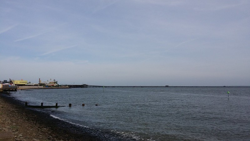
Although a long 3 mile or so stretch, this seemed to give a morale boost and I arrived at Leigh-on-Sea ready for more distance. By now Southend Pier was in reach and being able to see my goal, however far off and not getting bigger, this was enough to keep me pressing on. This was also new territory as my river walks last year hadn’t gone beyond Leigh. The path now followed the sea wall, and I started encountering people again.
First up was the HQ of the Essex Yacht Club, bought in 2001 from the navy where she served as HMS Wilton. Wilton (or HMS Tupperware as she was unofficially known) was notable for being the first warship in the world to be built of glass-reinforced plastic (grp), or what most people would call fibre-glass. GRP was particularly useful for a minesweeper as it reduced the risk of being blown up by magnetic mines. She still has her Bofors 40mm deck gun.

Now it was just a matter of slogging out the last few miles along the sea wall, sticking out like a sore thumb amongst the urbanites enjoying the seaside. With feet starting to hurt, a craving for a nice ice cream came across me and I made myself wait until the end. The pier started getting bigger and appearing closer, and with relief I passed Adventure Island and drew alongside the pier. That was enough, no extension to Shoebury for me. As I walked up through the town, I struggled to find a good ice cream shop that was still open and had to settled for a rather manky Cornetto from a newsagents opposite the station. It was only 60p though, but it had seen better days and was clearly old stock. I got on the train and in minutes all the work of the day was being undone as station after station flashed by, while I reflected on a job well done and the completion of my longest ever day walk. Now I felt ready for the 1o-in-10.
The route: Grays to Southend
 x
x
x